After a rejuvenating, gluttonous and pack-free zero day in Idyllwild, CA, we headed back out onto the trail and up into the San Jacinto mountain range. Unfortunately Carter had to take a brief hiatus from the trail to rest what is hopefully a minor strain in his knee. Gus and I climbed for the better part of the first day. Although it was a haul with all of the newly acquired food from our food re supply in Idyllwild, we were both relieved to have a break from the unrelenting desert heat that we’d been experiencing on the valley floor. We took a detour to the top of the San Jacinto summit where Gus and I split a coveted bar of Seattle’s Best Chocolate while enjoying a breeze-filled rest (thanks mom and dad!) .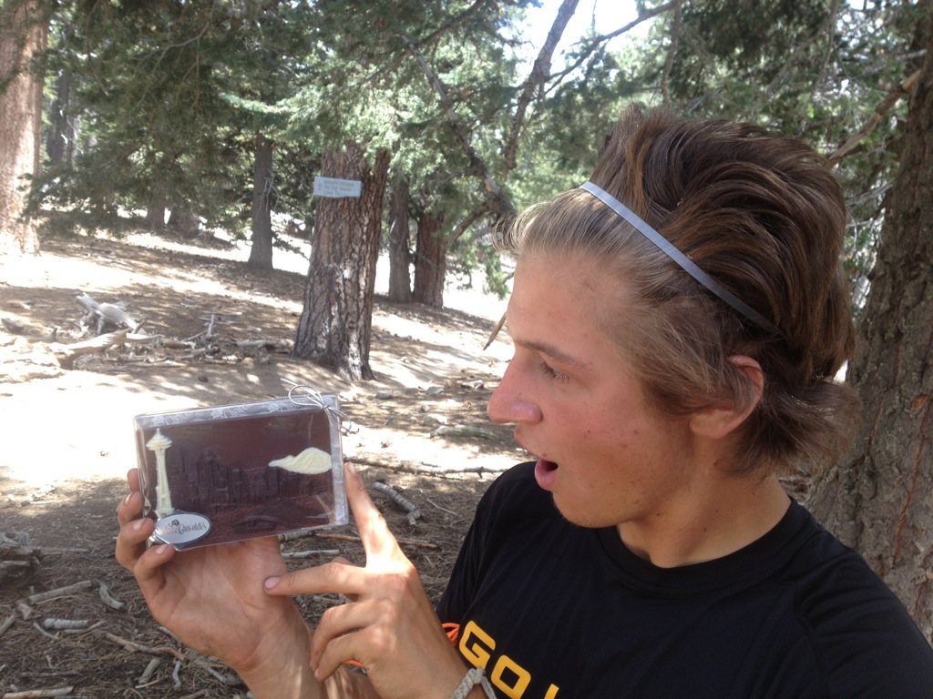
 That night was spent on top of Fuller Ridge where we could see the twinkling lights of Palm Springs extending out into oblivion on one side and headlights of cars driving down the I-10 on the other.
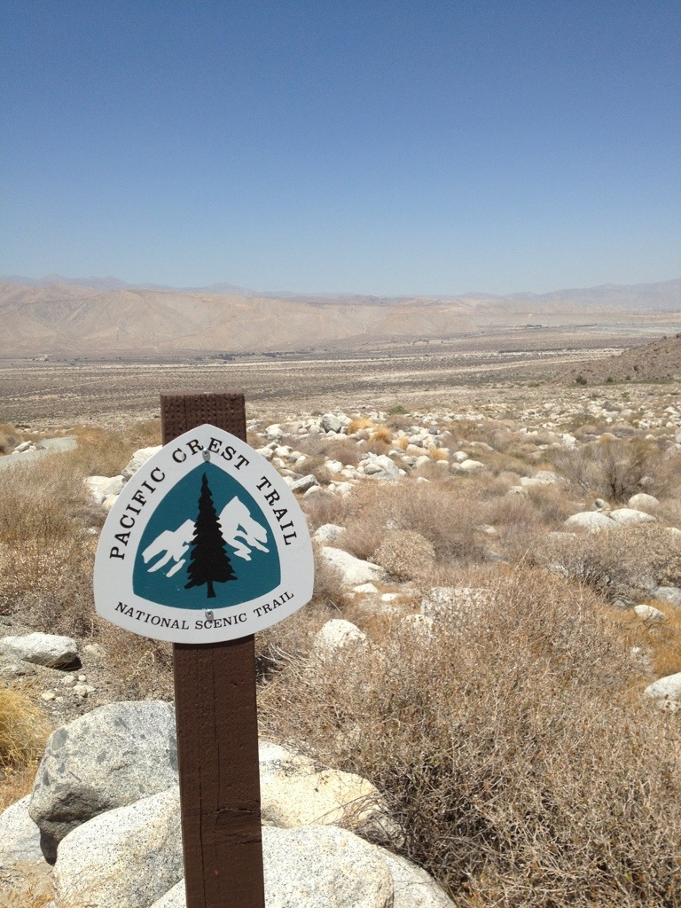
But what goes up must come down. While most days of hiking in the desert tend to blend into one another, the next day proved to be quite memorable, in terms of days hiked on the PCT. We had been heartily forewarned by many a PCT veteran, as well as Trail Angels, about the descent or The Descent from San Jacinto. The Descent consists of a 16 mile section of exposed switchbacks with no water sources or caches along the entire downhill slog. In addition to this nightmare for knees, there is the additional mental challenge of being able to see your destination the whole time: a bridge crossing the I-10. As the crow flies, it was 4.2 miles from our camp at Fuller Ridge to the I-10 crossing; however, by trail, the section included 20 miles of walking, 16 of them relentless downhill switchbacks. One fellow thru-hiker who had attempted the PCT last year told us his story of The Descent, where he ran out of water halfway down and had to call the sheriff. While the sheriff didn’t brave going up the switchbacks to rescue the guy, he did meet him at the bottom with plenty of water and an ice cream bar. Another Trail Angel warned us about this section and told us that two hikers had to be heli-evac-ed from The Descent last year due to dehydration.
Heeding these stories led to caution: Gus and i woke before the birds were up and got a nice and early alpine start at 3 am. This day tested both of our commitment to the trail most thoroughly. As new blisters formed on the fronts of our toes, while our thighs and knees screamed against the seemingly endless downhill, we were not too happy with the PCT. Gus threatened to break up with her while I gave her the silent treatment for a few hours. Despite our early start, the last two hours of traversing back and forth and back again were still gruelingly hot. We reached the bottom water faucet around noon, where I chugged a whole liter of water before even sitting down. Good riddance to that section.
We rolled into Trail Angels Ziggy and the Bear’s house around 4 pm. We were greeted by Epsom salt foot baths, a big tray of salad and about a pint of ice cream each. Thank goodness for Trail Angels!
There were about four other thru-hikers staying at Ziggy and the Bear’s, but having started at the tail end of the North Bound (Nobo) PCT thru- hiker season (most people start April 15th-end of May), we haven’t run into too many other hikers yet. According to one Trail Angel, there were 1200 NoBo permits issued this year. He estimated that 400 people would make it the first 700 miles through the SoCal desert, and only 200 of those would actually finish the trail. I guess the number one factor that contributes to people dropping out is the uncontrollable reality of injury. I’m convinced thus far that bodies are not meant to hike 20+ miles a day, carrying weight, for so many consecutive days. It results in some interesting pains and ailments to be sure. We’ve also heard that the mental challenge of continuing the monotony of walking every day takes its toll up in NorCal when you hit the half way mark at mile 1330, but still just haven’t made it out of California. And of course many other variables are at play in the low overall success rate like running out of funds, time or “real life” commitments that one needs to get back to. Although the figures are not promising, we’ve taken on the PCT motto of HYOH or “hike your own hike,” which really just means listen to your body and do what is necessary to hike sustainably rather than hiking fast. Even with the low percentage of PCT finishers, Gus and I were numbers 727 and 728 to sign the log book at Ziggy an the Bear’s for the PCT class of 2013, meaning that a considerable number of hikers had at least made it to mile 210.
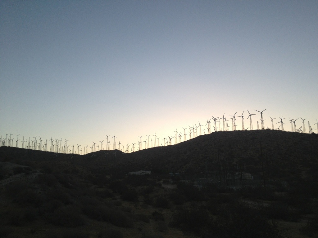
The next day (Thursday) took us through Mesa wind farm and up through the San Gorgonio wilderness, where we saw three different species of snakes, a few desert hares, many cute cottontails and about a gazillion lizards. We were definitely back down in the unforgiving heat of the valley which we dealt with by taking a four hour long lunch break to wait out the hottest part of the day in the shade.

Friday, or day 14, was one filled with surprises. The first one came about as we made our way into the San Bernardino National Forest and turned a corner only to find a big brown bear sitting on her haunches about fifty feet away…behind a chain link fence. As we ventured closer to investigate we found that not only were there two brown bears in cages, but there was also a tiger, a lion and a panther behind the fence on this property. After consulting the map with some confusion, we found that the PCT bypassed animal stunt cages (predatorsinaction.com) and that these animals were actually Hollywood stars who were relegated to these 20×20 foot cages when they weren’t being used for the big screen. This sight was as surprising as it was sobering and with little else to occupy my mind when walking for so many hours at a time, the next few miles I spent daydreaming about the wild safari animal rescue shelter I would make when I got back from the PCT.

I was thankfully distracted from my melancholy reverie by some trail magic : a cache of soda and waters, where Gus and I decided to make a hot lunch to use up some of the weight in our packs. Rehydrated spaghetti and meatballs for him and cheddar broccoli rice with tuna for me.

As we were finishing up our lunches, another pleasant surprise came wandering up the trail. A couple walked up and sat down with us in the shade and we began the typical hiker exchange. “Where did you start?” ( They were section hiking the trail) “where are you from?” (San Diego) “what are your names?” Deb, the woman answered, Halfmile, the man said. It was THE Halfmile, a real life PCT celebrity!
So, to back up a bit, there are two main ways that hikers navigate themselves along the PCT. The first is the old fashioned paper map method, where one prints out all 2663 miles of maps and then puts them in their re supply boxes along the way. The other, and more popular option we’ve found, is to download one of the three PCT apps and then cache all the maps to ones smart phone so that they can be used without needing to be in a service area. We re using a mixture of both methods. The most commonly used PCT map and app is called Halfmile PCT and not only does it have all 2,663 miles of the PCT on topographic maps, updated trail notes, water reports and fire warnings, but it also has a feature ( which can be a blessing and a curse) that uses GPS to tell you exactly what mile you are on on the PCT.

 We had speculated on who this mysterious Halfmile was. Was s/he a crazy ultra light hiker that thru-hiked the trail every year? Or was s/he an unmanned drone that flew over the trail and kept tabs on conditions? It turned out that Halfmile was a regular guy who liked to hike and had a background in IT. He was awesome enough to section hike the PCT and make the most useful app that is out there for PCT navigation.
Gus and I gave our thanks to the guy who had basically made it possible to get to where we were on the trail, and then headed on our way.
Not two miles down the road we happened upon yet ANOTHER bit of trail magic. This time it was a recliner couch with water and sodas and a cooler full of strawberry and fig newtons, bananas and cookies. There was also a much needed tube of IcyHot that I slathered all over my knees.
 Buoyed by our good fortune that day and encouraged by the prospect of seeing Carter in Big Bear City, Gus and I powered out 13 more miles, getting to the trailhead at 10 pm and making it our first (and hopefully only, for awhile) 30-mile day. Trail Angels, Papa Smurf and Mountain Mama, picked us up and took us to their house where we were fed delicious lasagna and ice cream and were able to shower and do laundry.
Big Bear marks being 1/10 done with the trail and almost halfway done with the SoCal desert, which ends at mile 700 in Kennedy Meadows . However, the most exciting milestone for me is that we are almost done with our first book of maps!
 Slowly but surely we are making our way home. We are back on the trail now and camped last night at mile 317. We celebrated the 300 mile mark with a dinner of Mac n cheese and tuna with snickers for dessert.
A humongous Thank You to our family friend Marion this week for housing Carter and making sure he followed the doctors orders of ice and rest. He is back on the trail in fine form and we hope that he (and all if us for that matter!) will stay that way for the next couple thousand miles!
Until next time, Elena

( our feet after one day of hiking)


I love your blog posts! Agonizing and whimsical! (Love the blue nails!)
Thank you for posting the good, bad and wonderful.
Sharon in Tacoma who wishes she’d know about this trail about 30 years ago.