So Long Summer (day 123/mile 2402)

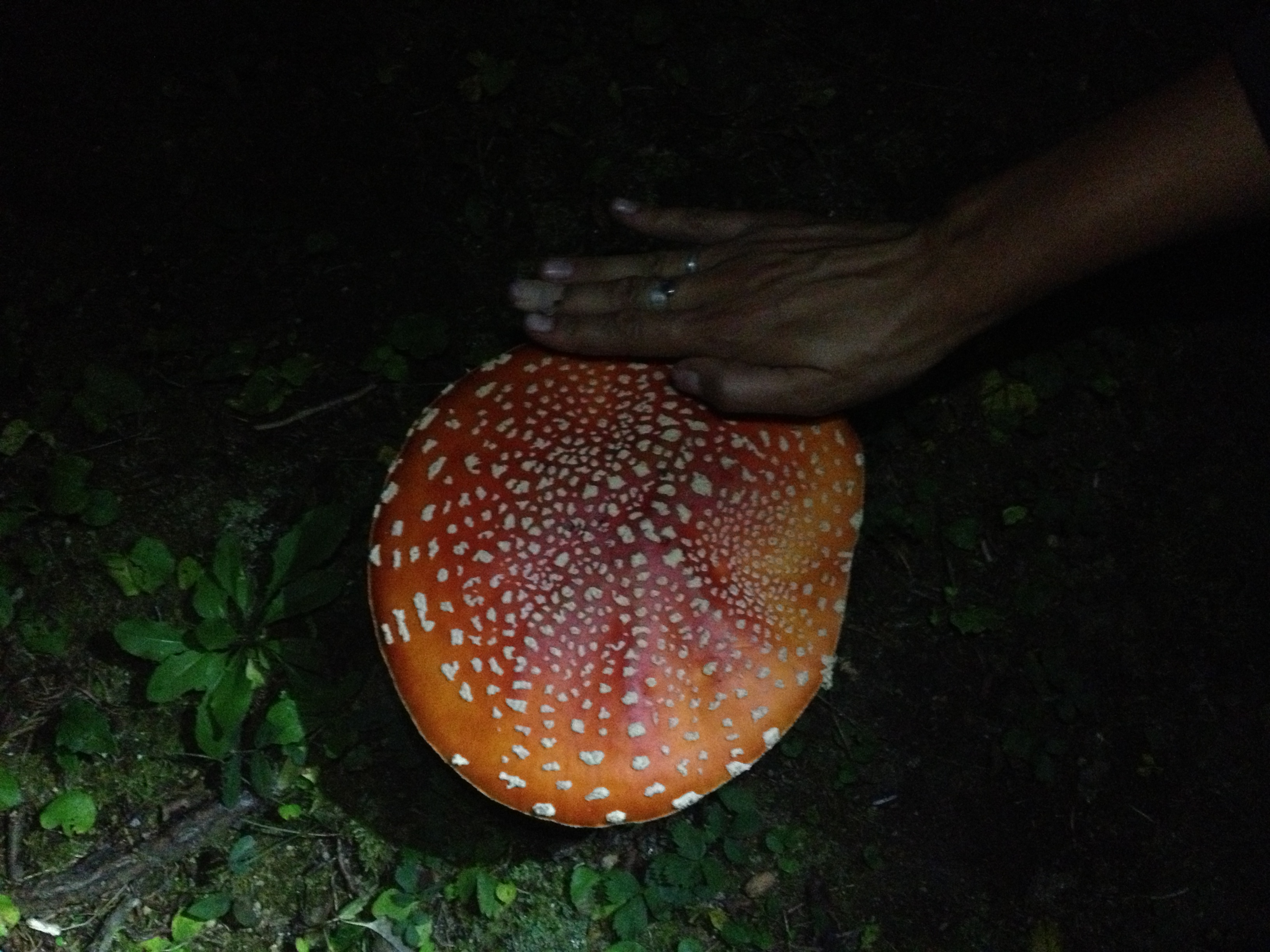
We have dubbed Washington “The ‘Shroom State.” Not because of a hallucinogenic experience, but because oodles of toadstools have lined the trail since we crossed the border. They come in every shape, size, form and color that one could imagine. It helps the miles pass by more quickly to play ‘Count the Amanita mushrooms’ or other fungus games. One day I even found mushrooms falling from the sky, only to turn around and find Gus spearing mushrooms with his hiking poles and propelling them over my head to rain down on the trail in front of me. Yeah. Fun Gus.

Winthrop 2012 156Winthrop 2012 219

Winthrop 2012 149Winthrop 2012 158

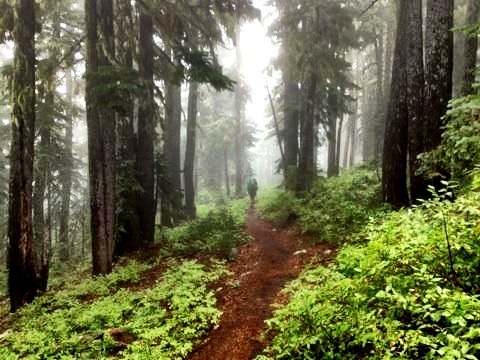
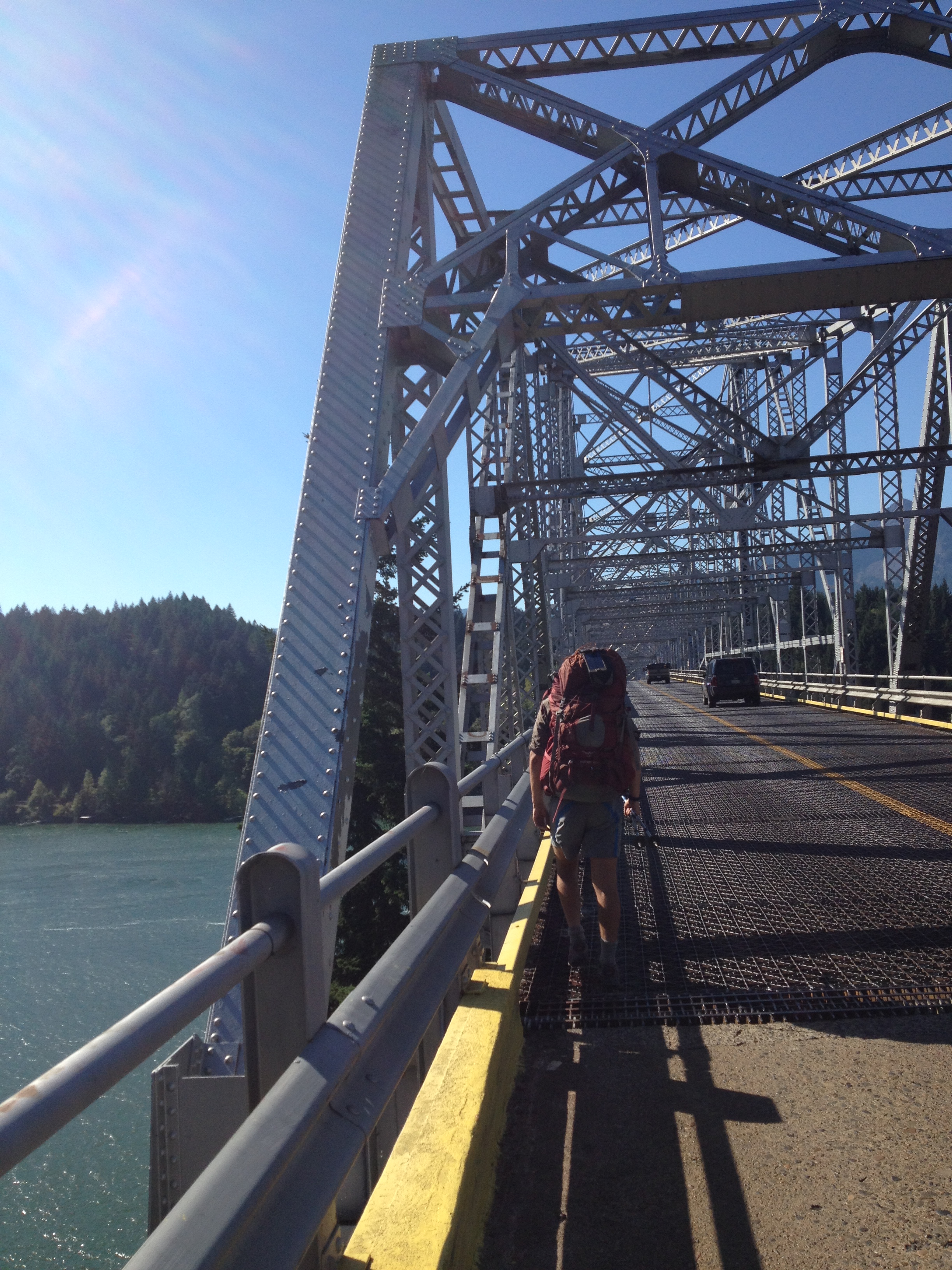
Walking across the Bridge of the Gods into Washington was a supernal experience. Despite the fact that there was no pedestrian walkway or shoulder over the two-lane bridge. Despite the fact that the bridge had a grated floor, where we could see 100 feet down to the river flowing below, seriously challenging my fear of heights. Despite the grumpy man at the toll booth, who had, maybe, seen one too many PCT hikers, telling us to ” walk on the left side, so you’ll see the car that hits you.” Despite these things, the feeling was sublime. Since our dad had kicked us out of the car at the Mexican border nearly four months before, we had traveled 2155 miles by good old step-by-step walking, and we were finally back in our home state. The home-land.

Winthrop 2012 125Winthrop 2012 126

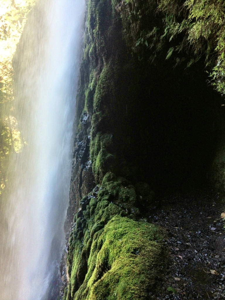
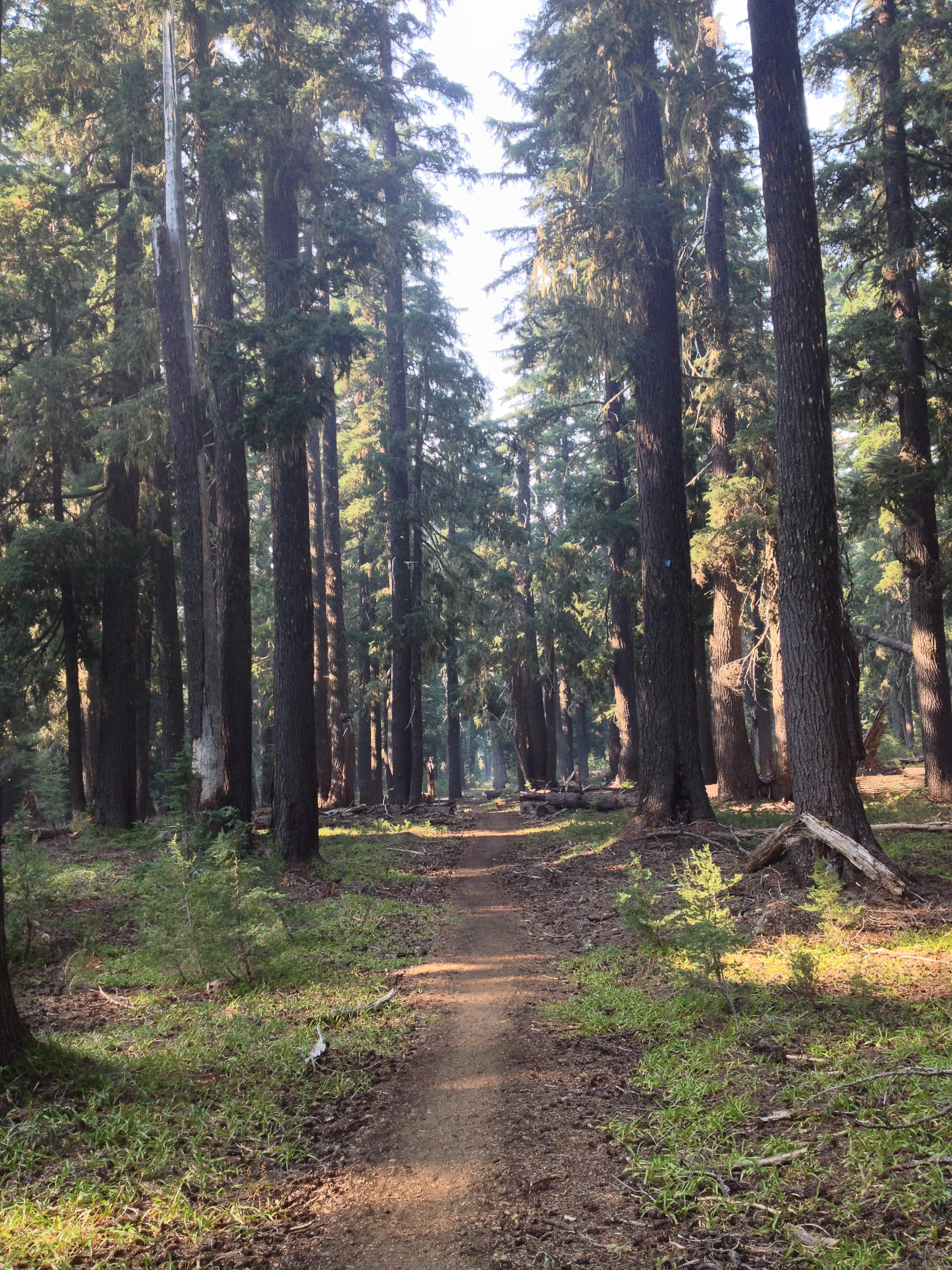
Having slept at nearly sea-level, down in the Columbia River gorge, the night before, we had to climb and climb, and climb and climb and climb to get back up into the mountains. We continued up switchbacks for what seemed like days, but what really was about 11 miles. However, the first five miles of Washington, before the ascent started, were absolutely euphoric. The air seemed fresher, the forest more interesting, the water was cleaner…We were buoyed by the knowledge that it wouldn’t be long before we would be hiking by the triumvirate of our home mountains (Adams, Rainier and St. Helens). And that the trail would soon take us over the three ski resorts that we were raised on: White Pass, Crystal and Snoqualmie. And most exciting of all, the Trail Angels throughout Washington would be the familiar faces of friends and family. So, exuberated by these thoughts, the seemingly interminable switchbacks were much more bearable than they would have been otherwise.

Winthrop 2012 132

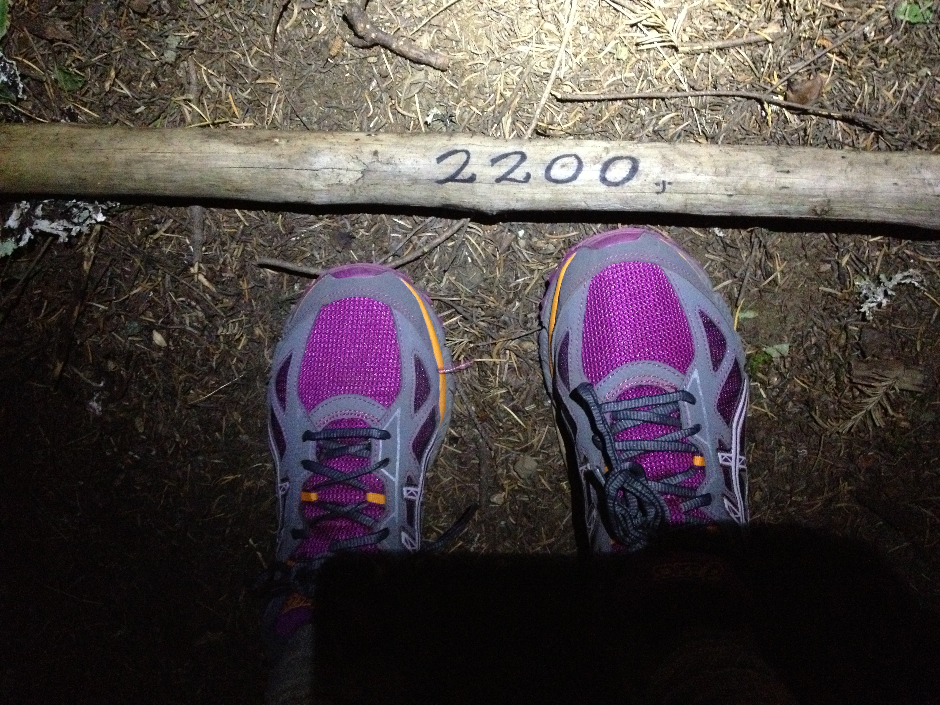
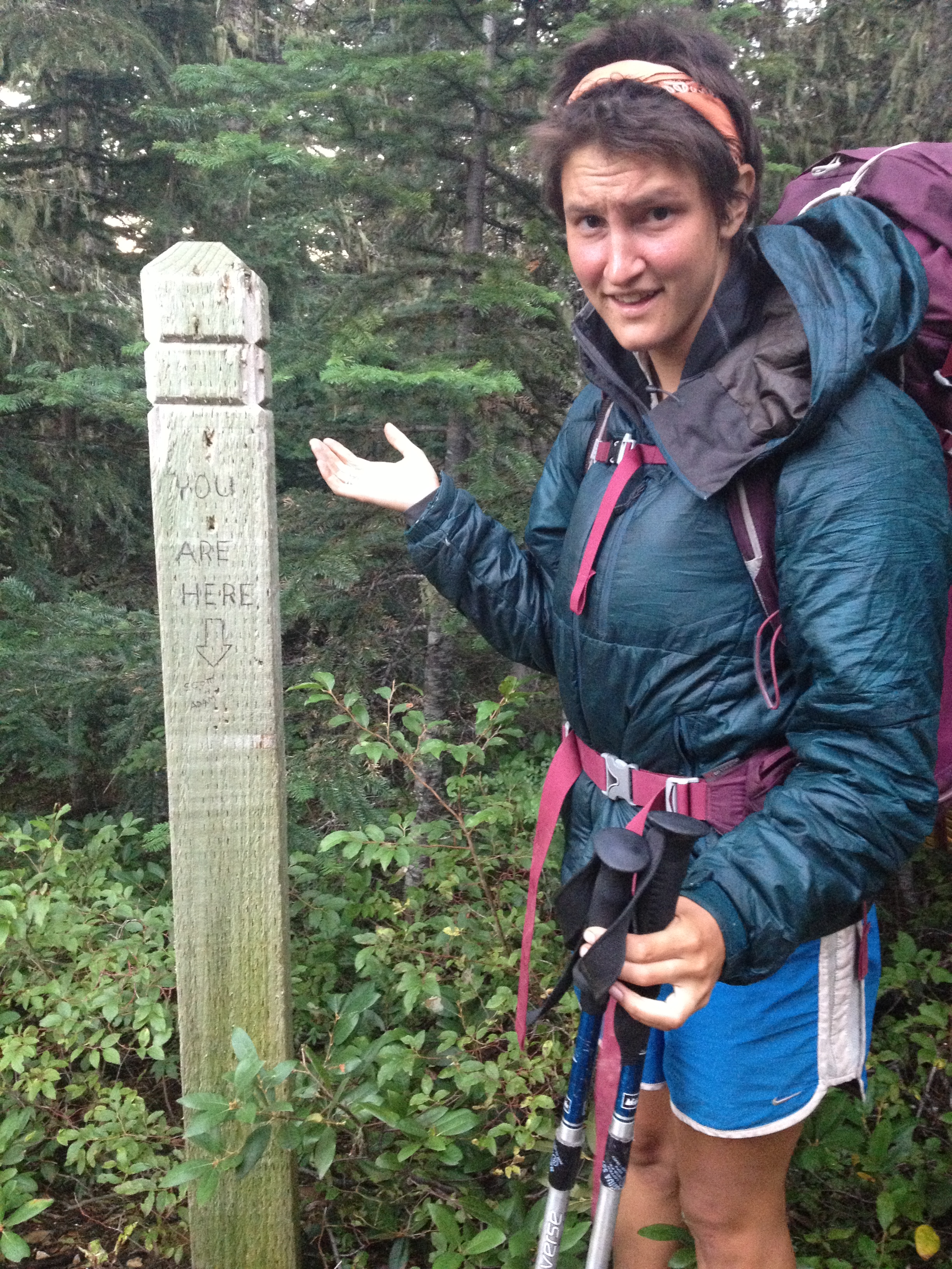
(Mile 2200 and new shoes)

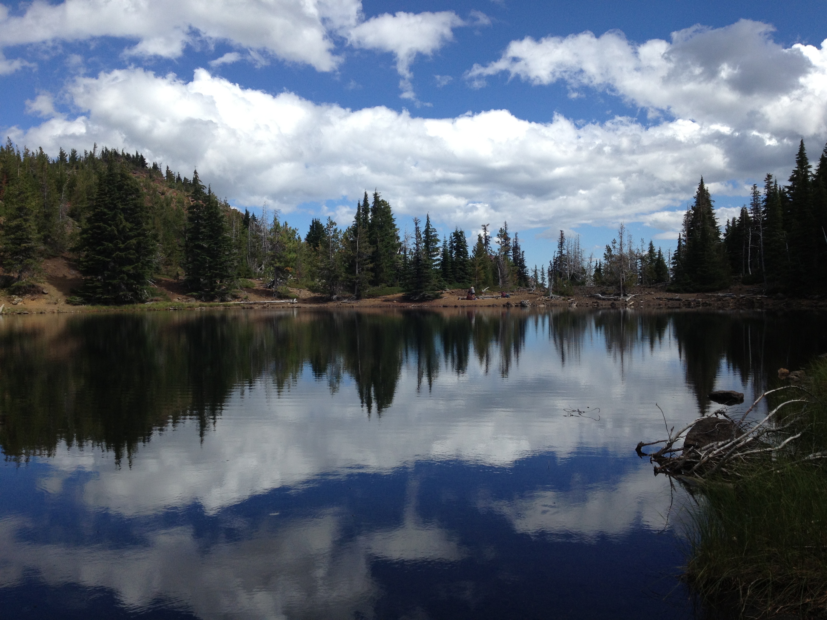
The next day we meandered through the Indian Heaven Wilderness, unable to resist stopping at many of the beautiful blue alpine lakes for a rest or a swim. We ran into a group of middle-aged men out for a ‘boys weekend,’ who paid us homage and literally kow-towed to us right there at our feet on the trail. They praised us for being such ‘mountain people,’ but we told them that they were gravely mistaken and that your average boy-scout has a more extensive knowledge of survival skills than we do. After four months on the trail we are very proficient at making mac ‘n cheese and following a (very well-marked) trail. Half the time our maps don’t even download or our phones are dead. But that is all. We thanked them for their reverence nonetheless. That night we hiked late (like 11 PM) and found a nice flat place on the trail to sleep.

Winthrop 2012 341Winthrop 2012 134

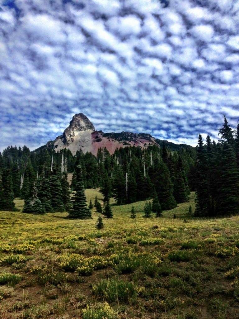
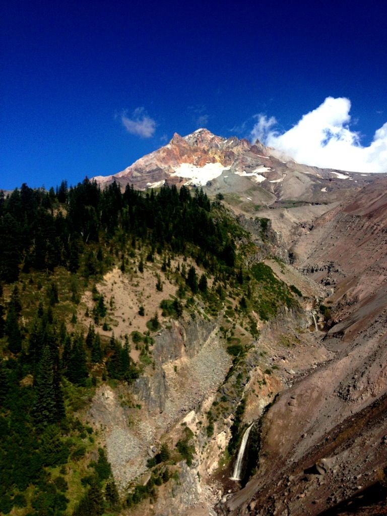
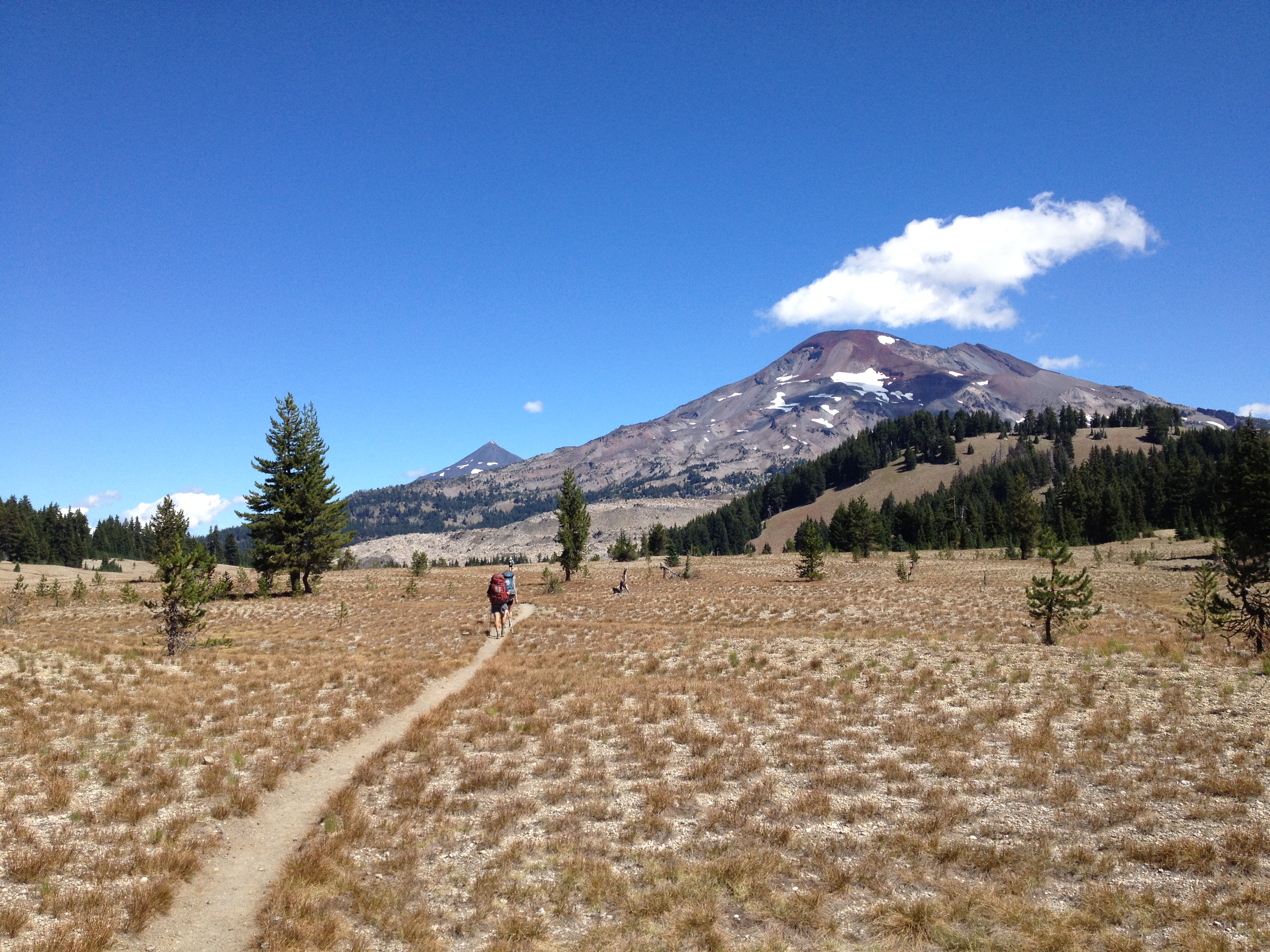
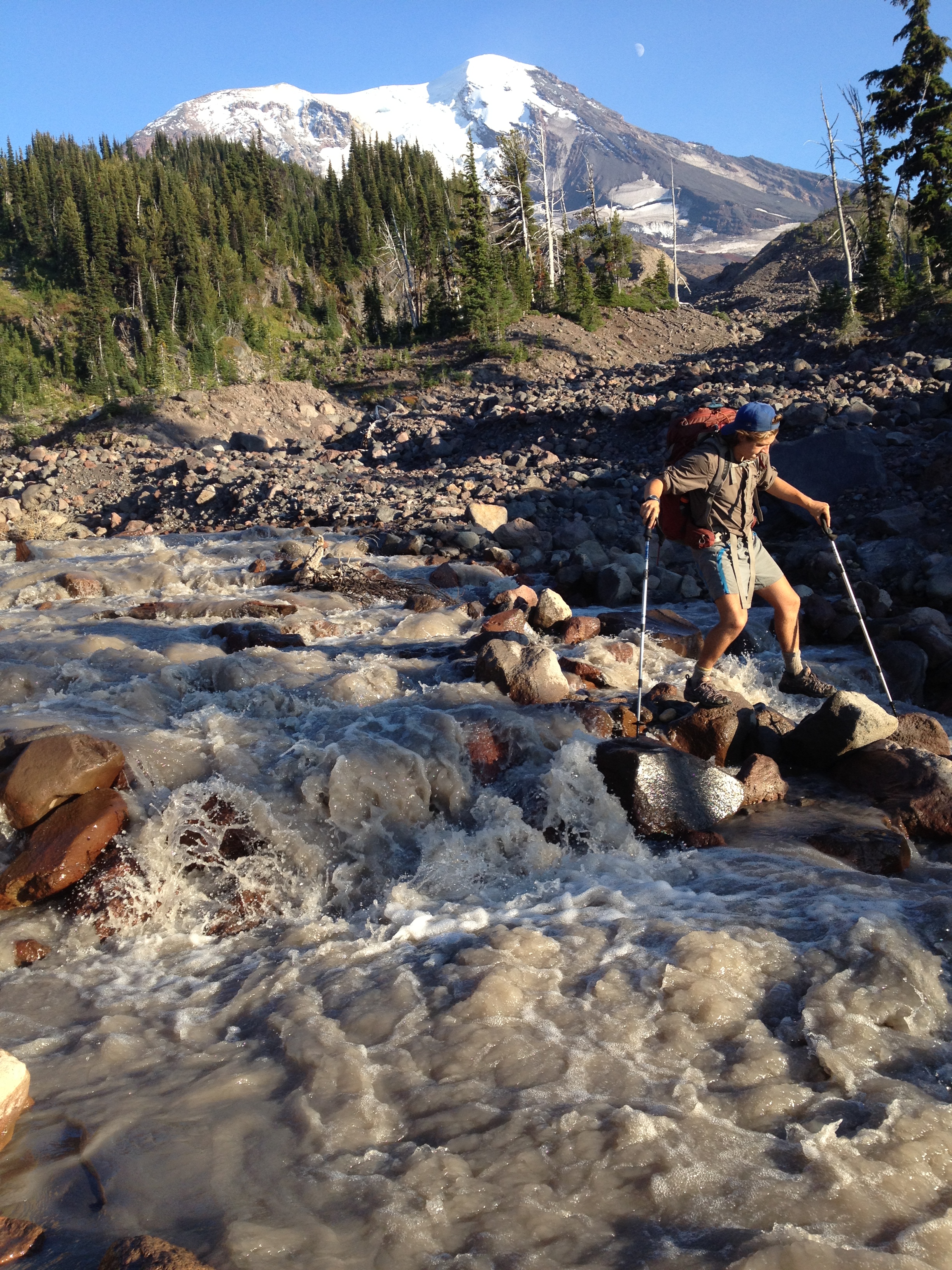
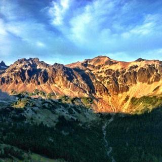
Day 116 brought with it views of Mt. Adams galore. We approached the barren south side and skirted around her west face, crossing many a river in the process. At one point we were only three miles from the 12, 281 ft. summit. Had we the time, energy, or will, It would have been a glorious day to climb. The north face of Mt. Adams was almost completely covered in snow and looked much more like the mountain I was used to seeing from the Tacoma area. The day was splendid, as we soaked up the Washington beauty.

Winthrop 2012 169Winthrop 2012 186

Winthrop 2012 178Winthrop 2012 349Winthrop 2012 199 Winthrop 2012 168Winthrop 2012 129

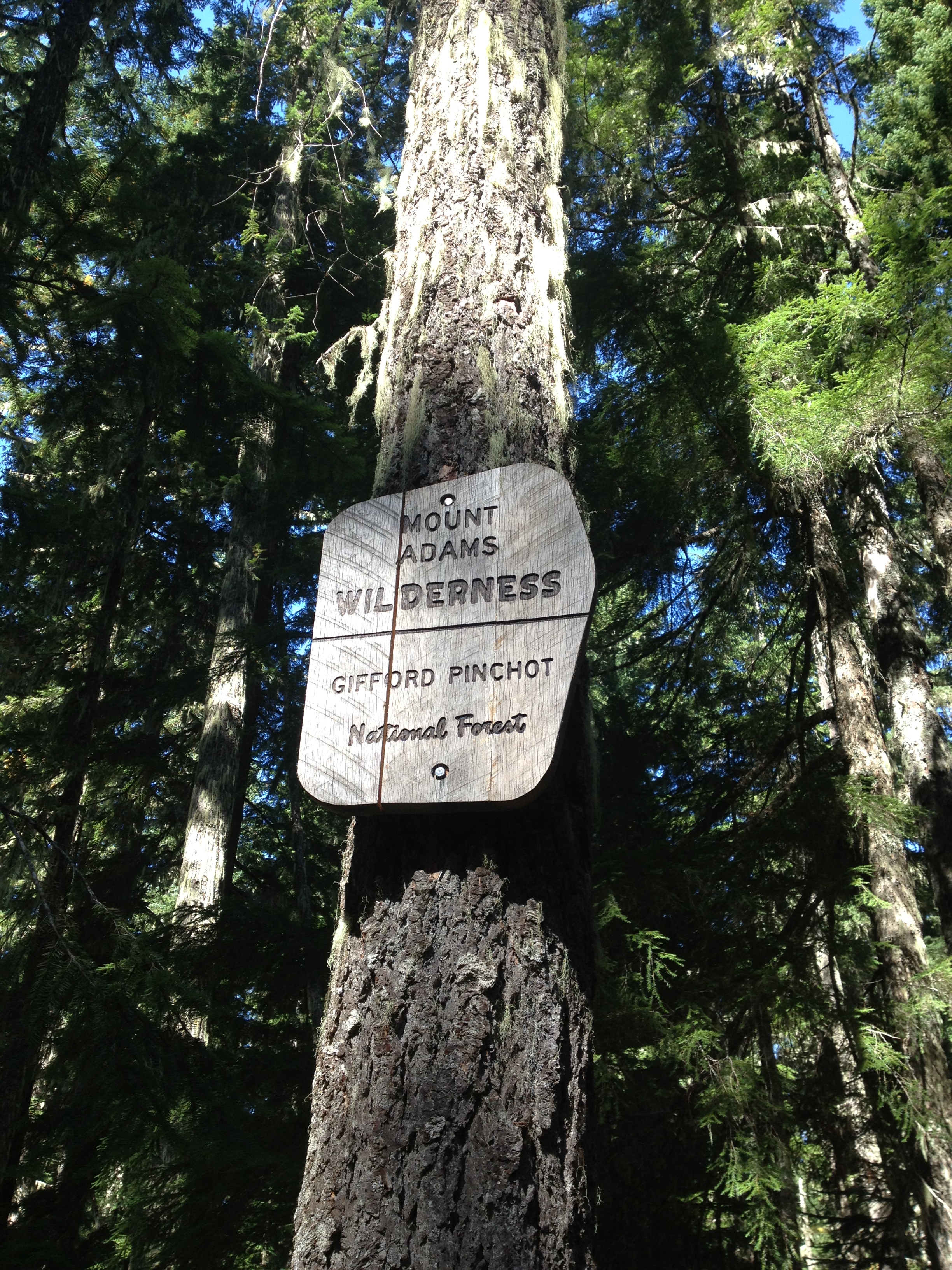
Saturday, however, took a turn for the hungry. As we left Mt. Adams Wilderness and entered back into the no-mans-land of Gifford Pinchot National Forest, we realized that we were cutting it close with what we had in our food bags. Somehow, trying to ration and knowing that you only have x amount of calories left to eat gives you the urge to eat that much more. I resorted to the infamous tuna poptart sandwich (sweet & salty, protein & carbs) and Gus to the ‘mix-everything-left-in-your-food-bag-and-cook-it’ tactic. That night we broke down and did that which we had never done before – that is, ask weekend backpackers if they had any food to spare. Luckily it was a Saturday, and furthermore, we had made it into one of the most beautiful places in the world-the Goat Rocks Wilderness. Thus, there were weekend adventurers galore. One group was generous enough to gift us with a bag of salted nuts, jerky and even a fresh cucumber from a hiker’s garden. We thanked them profusely and made it about five minutes down the trail before stopping to devour our plunder. Hungry is as hungry does, I guess.

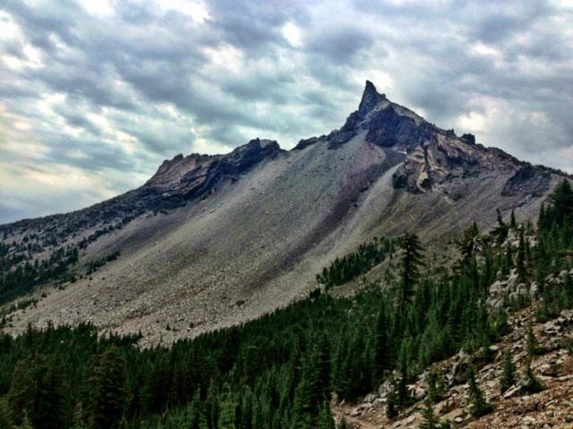
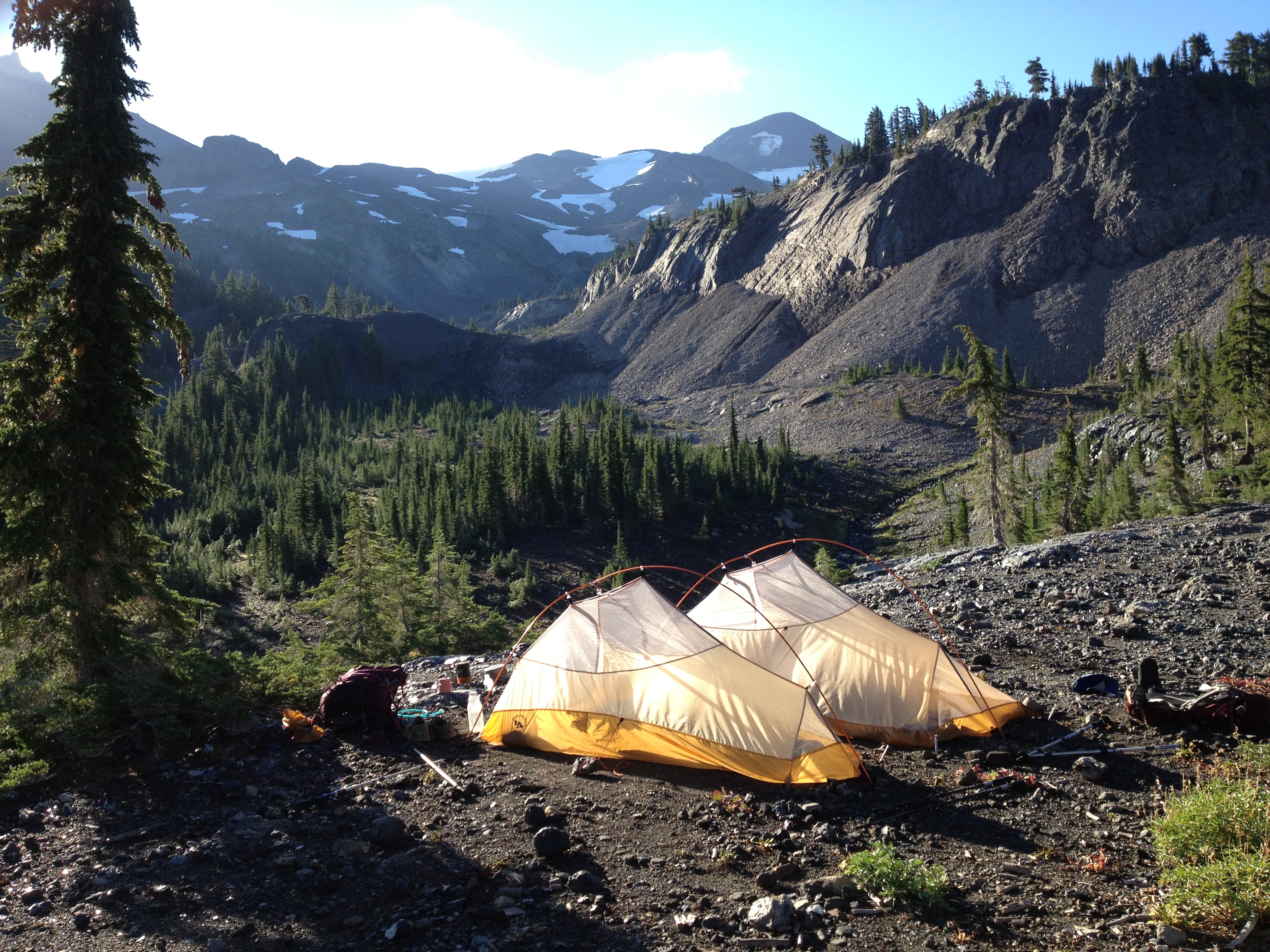
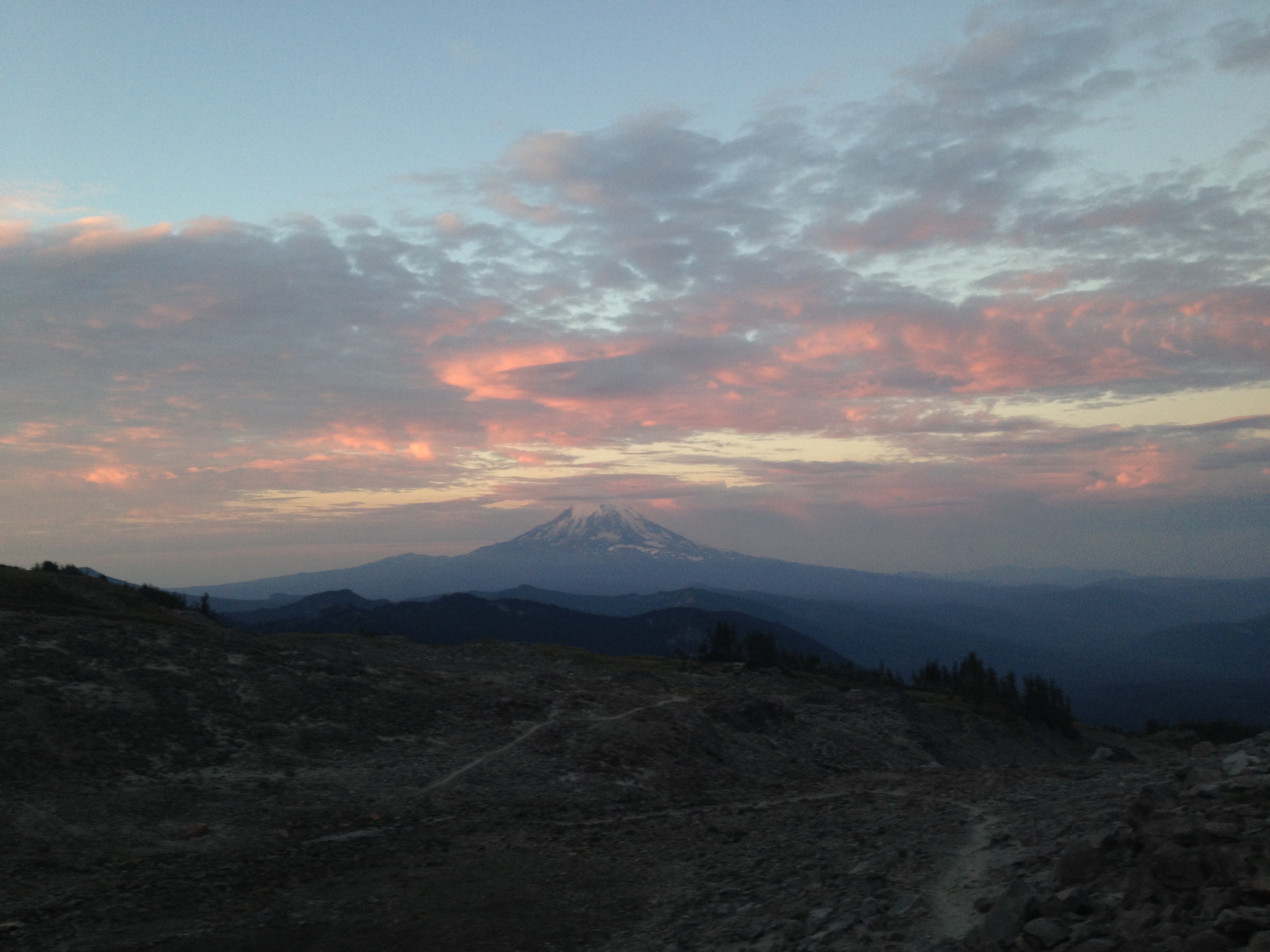
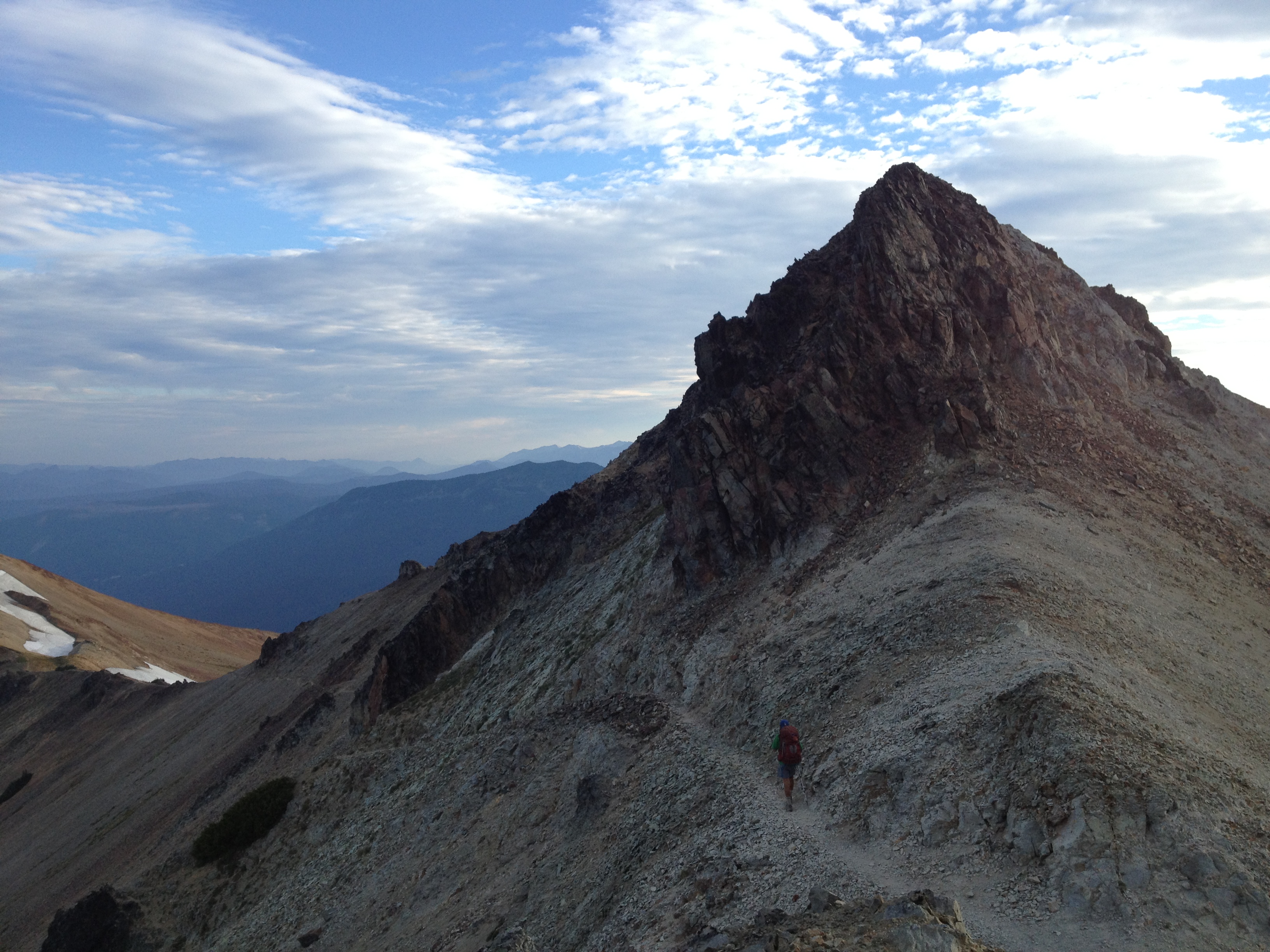
The next chapter of Washington brought us the highlight of our trip so far: the Goat Rocks. We walked from Snowgrass Flats over the Knife’s Edge just as the sun was rising and were treated to a pink and purple alpenglow on both Rainier and Adams.

Winthrop 2012 238Winthrop 2012 352Winthrop 2012 351Winthrop 2012 350Winthrop 2012 348Winthrop 2012 263Winthrop 2012 257Winthrop 2012 252

Winthrop 2012 249

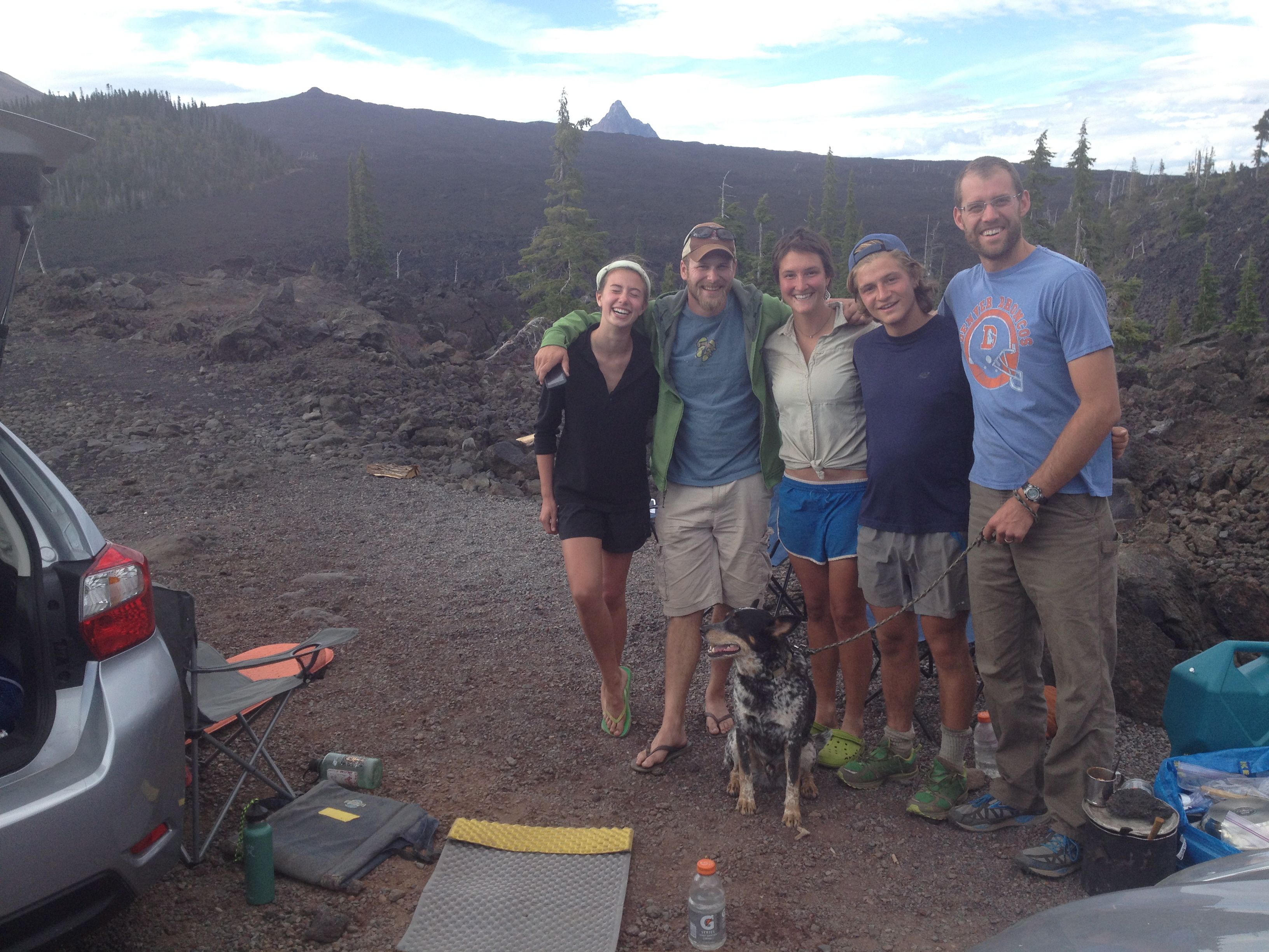
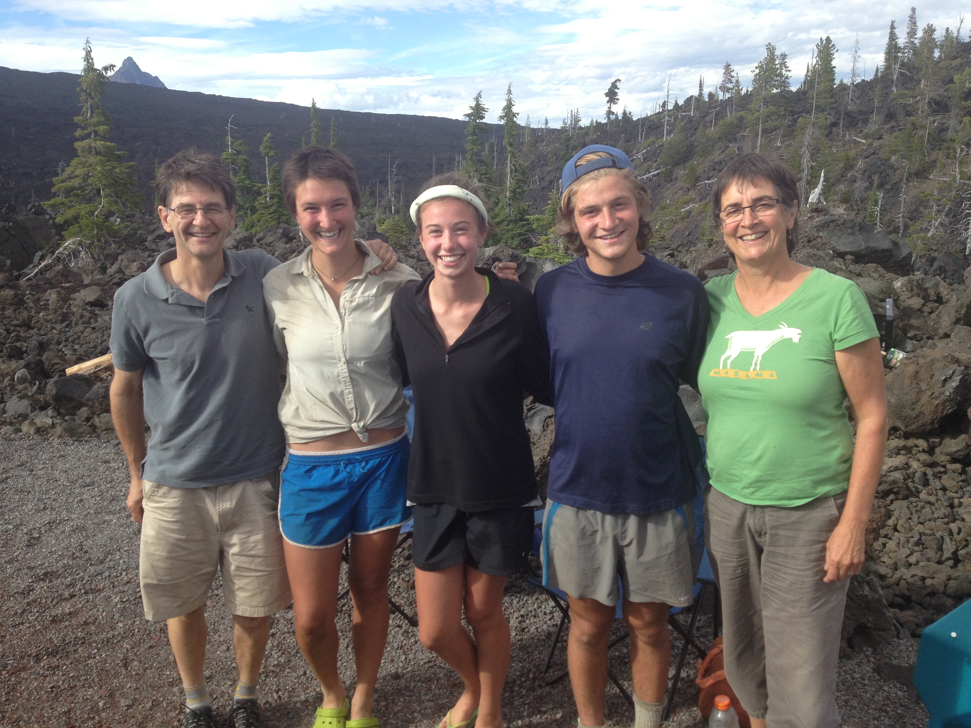
We were treated to a wonderful night and delicious dinner at Tatoosh Meadows in Packwood. So many thanks to Melisa, Jill, Tricia, our Mom and Dad, and the dog pack, for coming out and being such wonderful hosts. It felt like a night in heaven.

Winthrop 2012 271Winthrop 2012 274

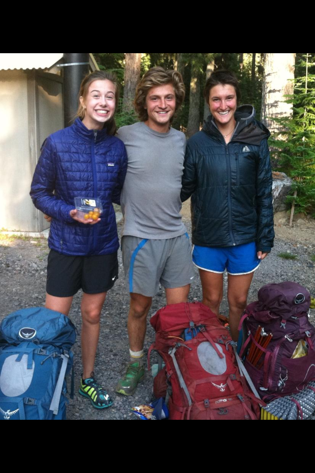
After being dropped off at White Pass Kracker Barrel Store around 11 am the next morning, we found it difficult to get back out onto the trail. In part, because a pretty consistent drizzle had commenced with no signs of stopping anytime soon, but also because a pretty constant stream of fellow PCT hikers had found their way into the store/café and we had pretty much taken over. We reconnected with a few different people we hadn’t seen in a couple weeks, but we were most excited about seeing some people who we hadn’t seen since the desert. We even saw one guy that we hadn’t seen since the first day of the trail, down at Lake Morena.

I’d say about a third of the other thru-hikers we’ve met are like us — newbies to the whole long-distance thru-hiking thing. The remaining two thirds have hiked some other 700+ mile long distance trail, the most common being the Appalachian Trail (the AT). It was fun to see some of the other newbies we ‘d last seen 1700 miles before. They seemed older and wiser in the ways of the trail; we only hope we gave them somewhat the same impression. Not only are we rookies in the thru-hiking game, but we are young-uns as well. Just last week we met our first other hikers who recently graduated from high-school. They were the only other two male hikers with conspicuously clean-shaven faces. We’ve met a few other hikers recently graduated from college but I’d say the average age of fellow PCT-ers ranges from 26-45 (ish). There are a few inspiring white-haired souls roaming the trail as well. I hope that I am half as fit as they are when I reach that age.

Winthrop 2012 286Winthrop 2012 281

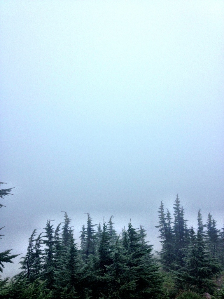
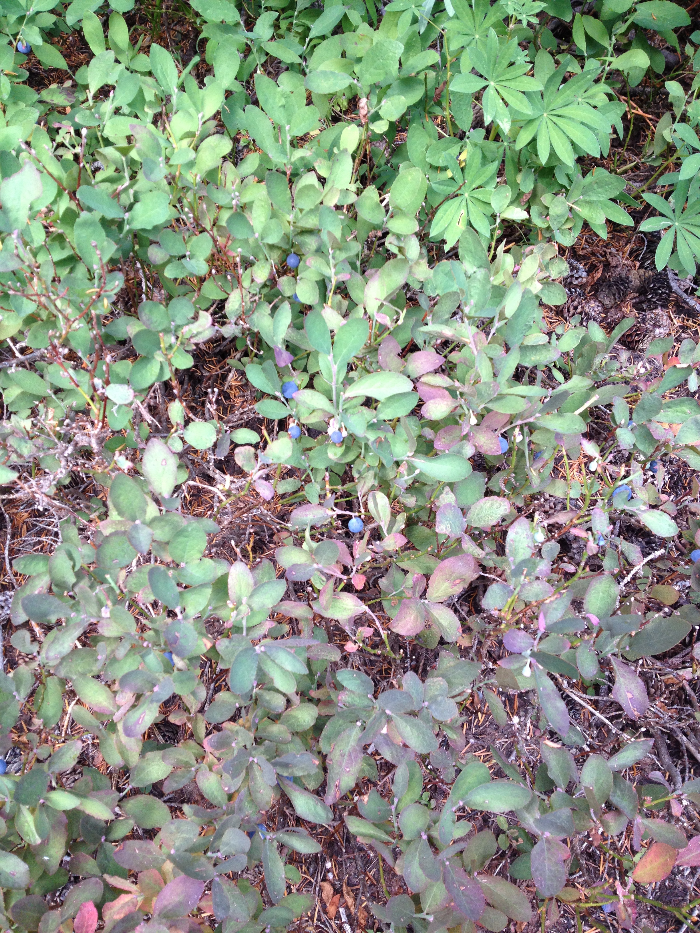
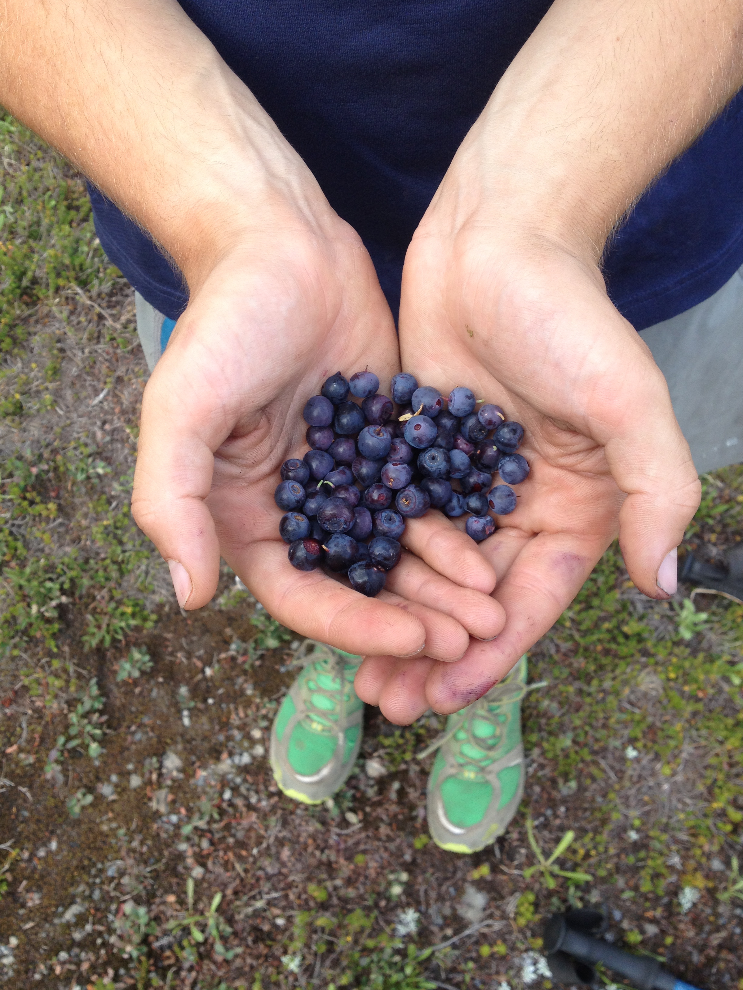
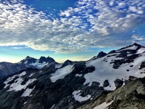
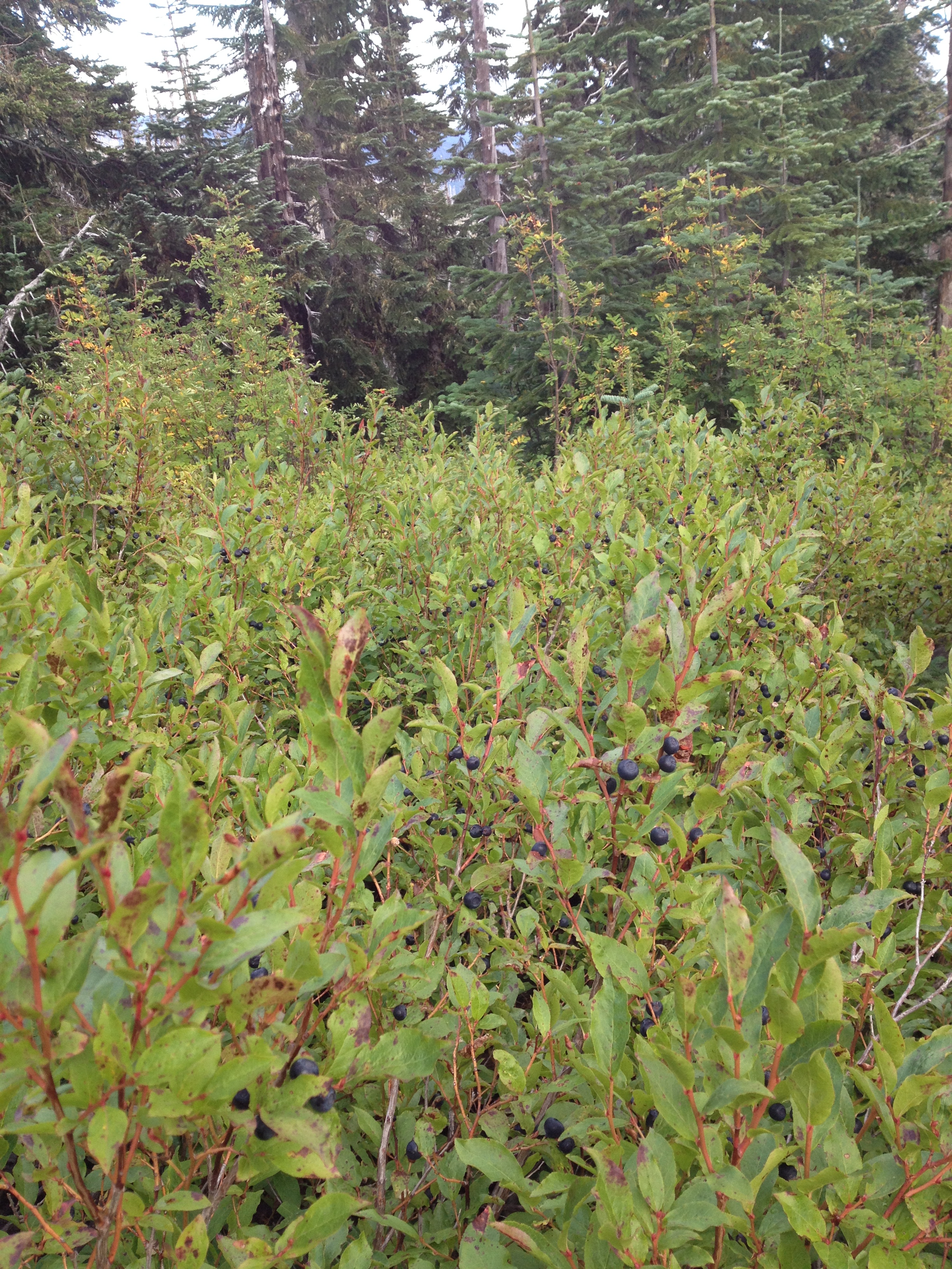
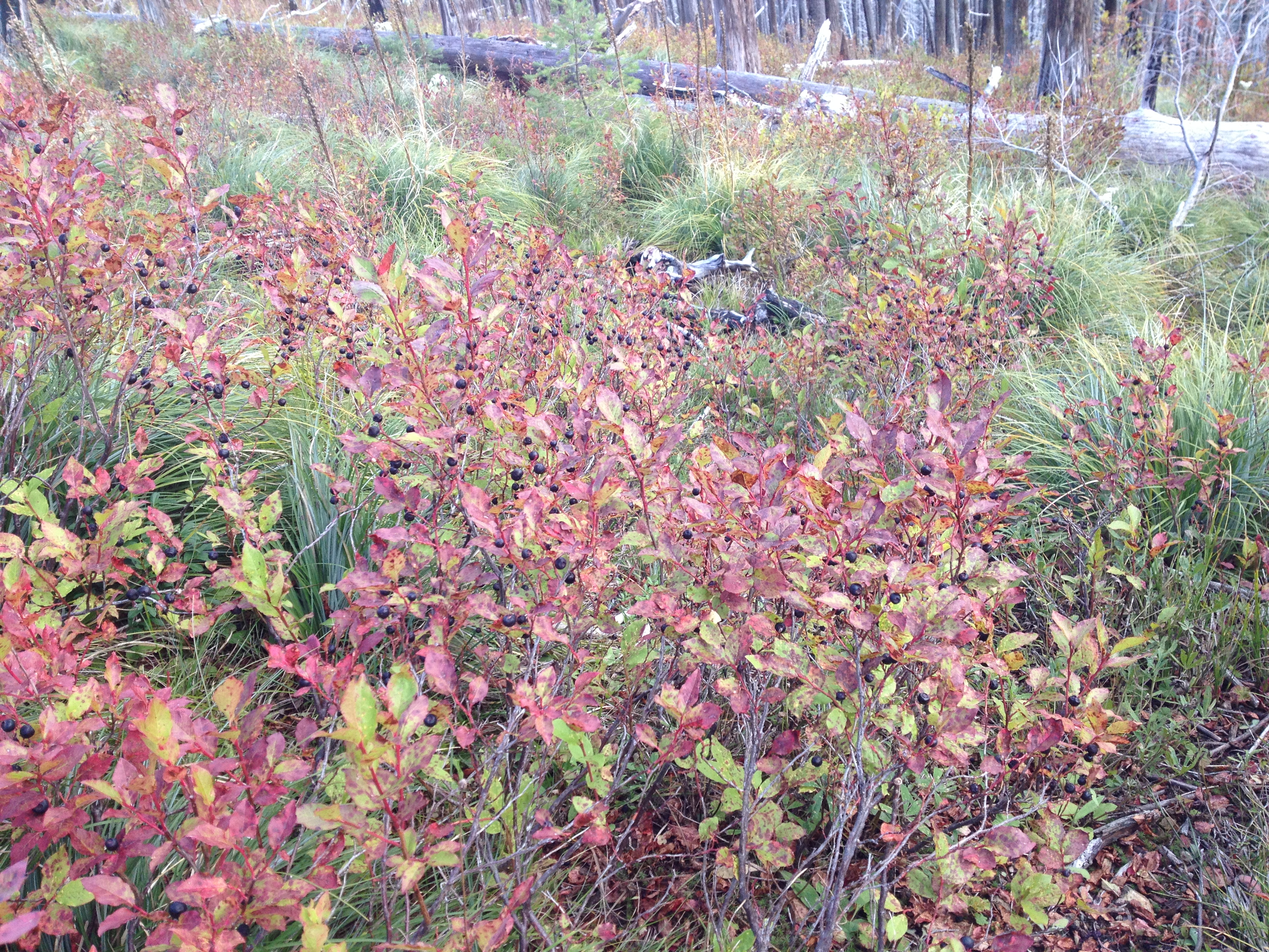
We’d heard mixed reviews about the White Pass to Snoqualmie section; beautiful views of Rainier, but lots of hiking through logged forests. Unfortunately, we had an experience similar to the one we had in Jeff Park. Rainier was nowhere to be seen. For 100 miles we hiked in and out of the clouds and rain. We even made it into the boundaries of Mt. Rainier National Park without once seeing our glorious mountain. However, we barely noticed the lack of view due the bounty of huckleberries that lined the trail almost the whole way through this section. It was a constant struggle of will power to keep on going and not stop for hours to pick. There was always a bush with more berries, bigger berries, bluer, sweeter berries. We also discovered at least three different species of huckleberries along the trail, and became quite the connoisseurs of the subtle huckleberry flavor.

While the lack of views did not bother us, knowing quite well that we would have limitless views of Rainier when we got home, autumn’s dramatic entrance into our trail experience was a different story. The seasons are a-changing in Washington. The two most consequential developments to our life on the trail are 1: shorter days and 2: more moisture. In the desert in the summer we could walk from 5 am to 10 pm without turning on our flashlights; almost 17 hours of pure, uninterrupted, blissful walking. These days we get about 13 hours of light. This translates into less walking, and thus, lower mileage. The number of hours of walking you do a day translates directly to how fast you get to Canada. As far as walking goes, even the ‘fast’ walkers only go about three miles an hour. There is not much variety in speed, like there is in running. For example, the two speed record holders this year did the trail in 59/60 days not by walking significantly faster than all us other thru-hikers, but by walking from 4 am to midnight every day.

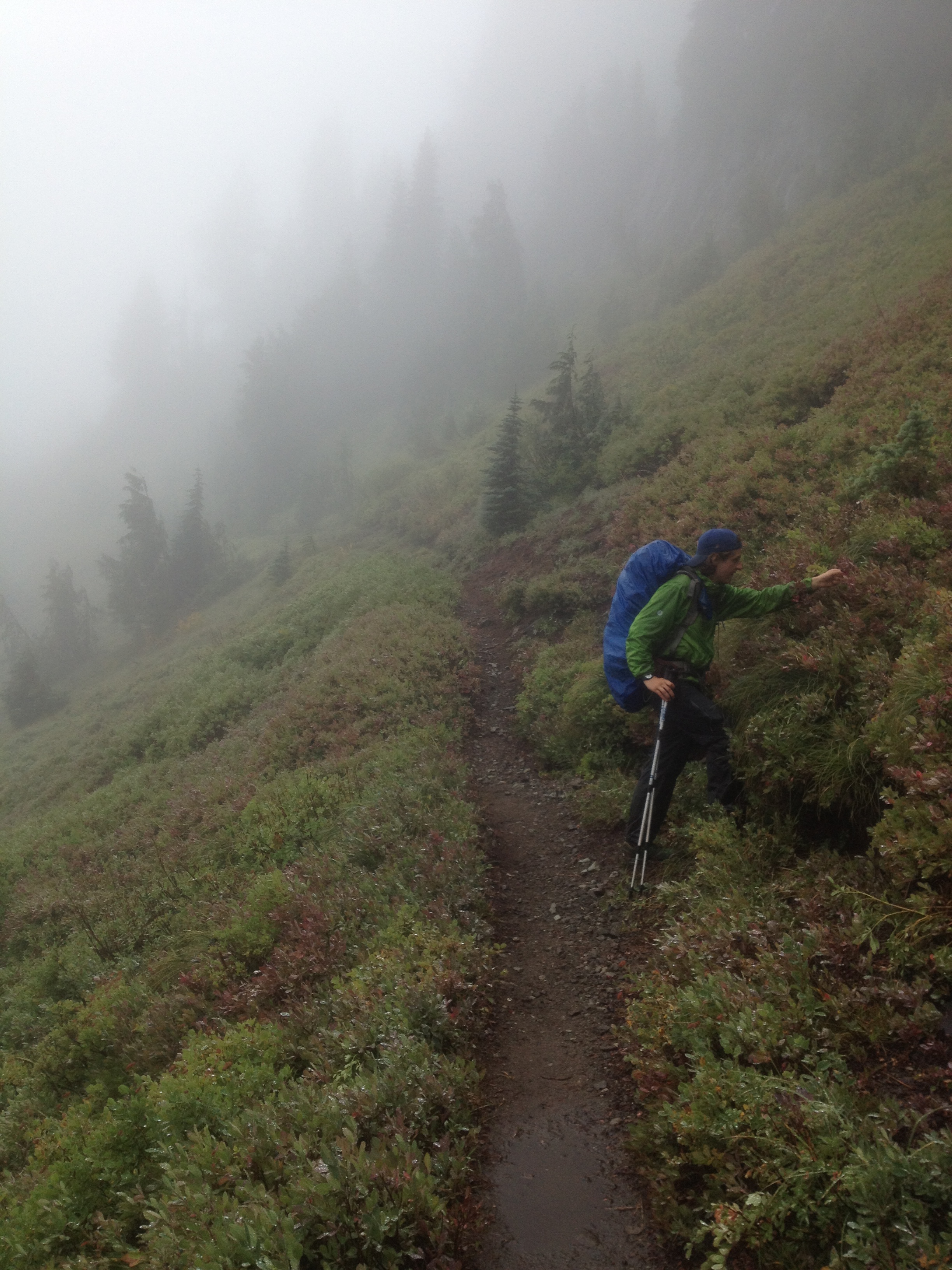
Constant moisture is another adjustment that we are trying to get used to. From White Pass to Snoqualmie, there was almost constant drizzle, rain or mist. Since our sleeping bags and warmest layers are down, and down becomes worthless when wet, it has become our biggest challenge to protect those feathery essentials from the Washington’s autumn dampness. Other harbingers of fall have been the slow transition of green to red in the trees and bushes lining the trail, and the crisp, cold smell that is distinct to this time of year.

Winthrop 2012 297Winthrop 2012 332Winthrop 2012 333Winthrop 2012 299

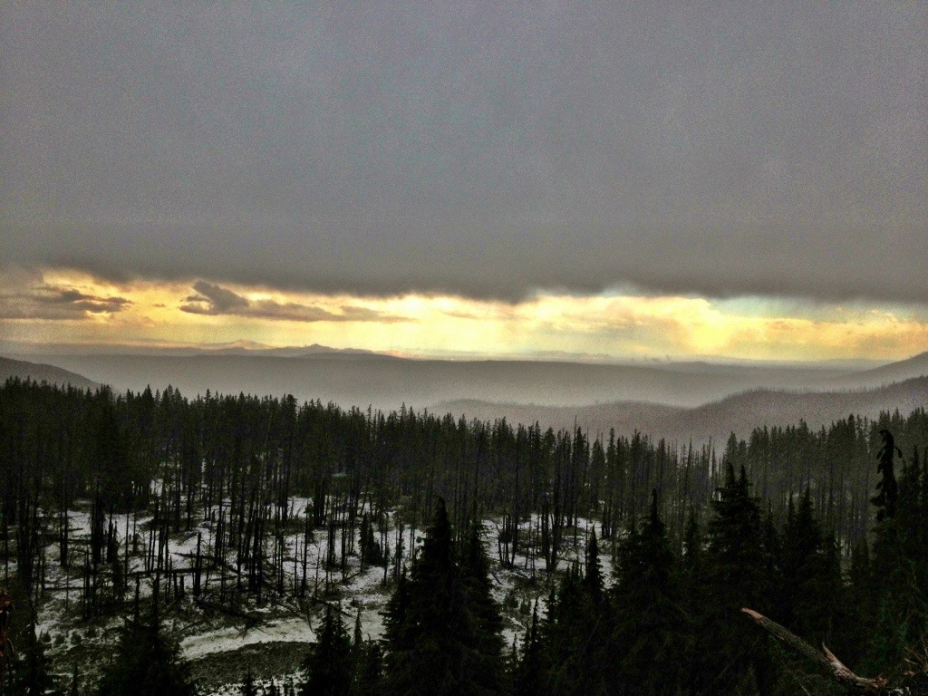
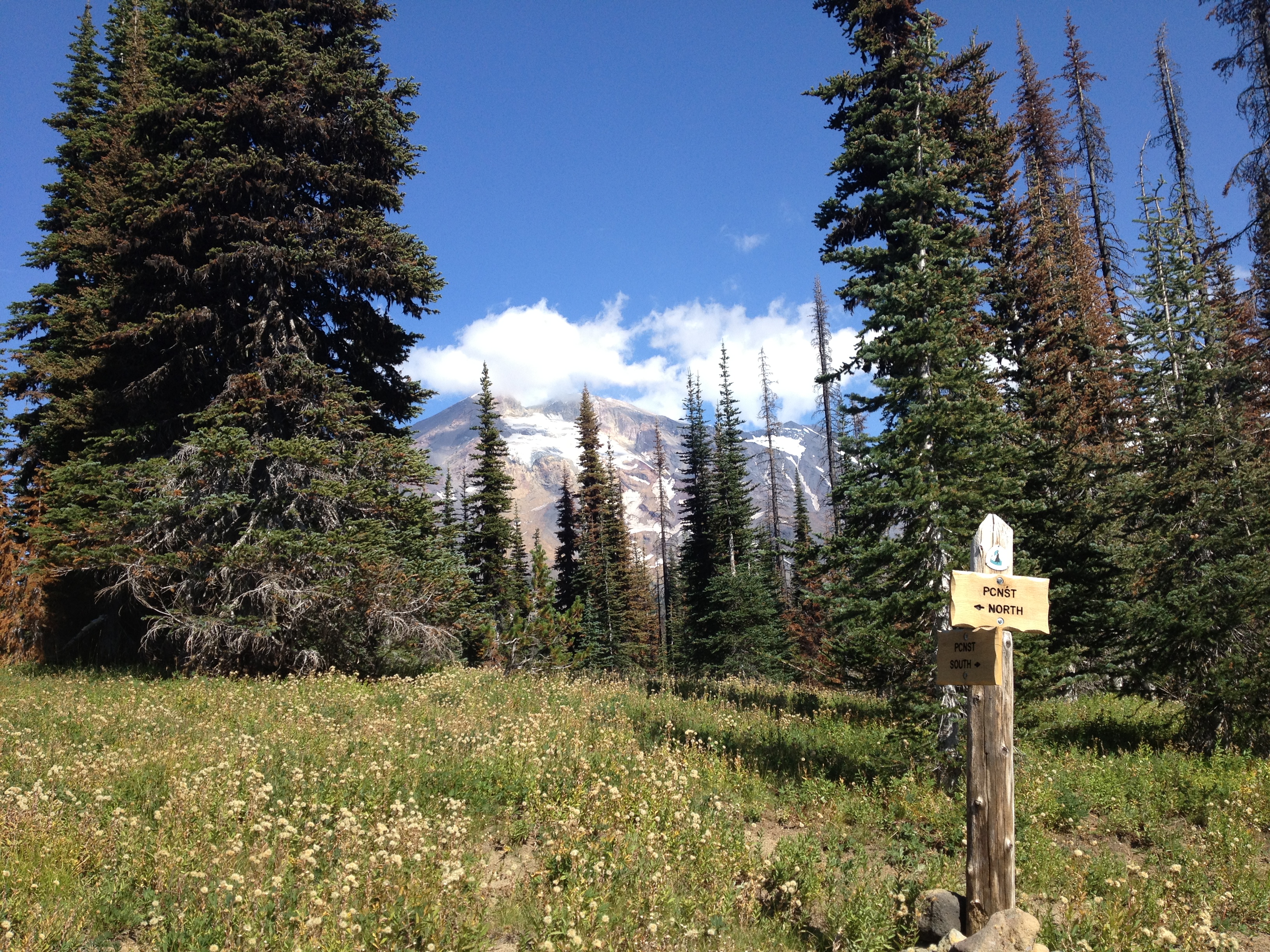
(Our best view of Rainier in Mt. Rainier National Park)

After four days of soggy hiking, we walked across the slopes of Snoqualmie Pass, the same slope on which I painfully learned to snowboard. We were greeted by our mom and Kava and were driven down I-90, to highway 18, onto I-5 and back into the beautiful city of Tacoma for a day off.
Today (Saturday), we relaxed by attending Etta Projects 10th Birthday celebration where we drank the Etta brew, listened to some great live music and celebrated surpassing our fundraising goal of raising $1 per mile that each of us walk ($5,326). Thank you to ALL of you lovely people who donated. We raised over $6800 to go towards the many wonderful projects Etta Projects has going, including building water filtration systems and ecological latrines in rural villages in Bolivia. For more information on this fantastic organization visit ettaprojects.org.

20130921-210318.jpg (Executive Director of Etta Projects Pennye Nixon)

We head back out to the trail tomorrow for our last and final stretch. 270 miles to go. We’re hoping hard that the snow in the Northern Cascades will hold off for just two weeks longer and that the colors and crispness, rather than the damp and coldness, will define our final fall days on the trail.

Until next time,
Elena

Winthrop 2012 071Winthrop 2012 294

Oregon: Act Two (Day 113/ Mile 2155)- Gus

I can see the land of state sales tax across the Columbia River from where I sit. The sight is glorious.

Elena and I began the second half of Oregon from where we took Labor Day off at the beginning of the Mt. Washington Wilderness at McKenzie Pass. The trail followed miles of lava beds, thankfully solid lava, as we wound our way around Mt. Washington.

20130910-200340.jpg

We set up camp early as we saw some ominous looking clouds float towards us. The weather still hadn’t cleared up, or struck, by the time we commenced our northward movement the next day. As we came around Three Fingered Jack, we were only able to make out one of the fingers. I cannot speak to whether the other two fingers are still there or not, since the view was obstructed by low clouds. Our progress that day was slowed by the abundance of huckleberries alongside the trail. By mid afternoon the visibility was limited to half a small lake and the gods were going to war in the clouds where they were creating frightening booming and crackling noises.

20130911-111407.jpg

Soon enough the heavens opened and dip ‘n dots, blueberries, and marbles of ice were flying horizontally. Bright flashes filled the sky a few times every minute accompanied by loud thunder. Visibility increased enough for us to realize that we were hiking along an exposed ridge. We quickly hurried off of the trail so as to not become human lightning rods.

20130910-203010.jpg

20130910-203033.jpg

20130910-203042.jpg

20130910-203107.jpg

Once the storm calmed down we trudged on northwards in what had  been newly transformed into the Pacific Crest Puddle. Finally we found a dry area to set up camp. Our campsite had a beautiful open view of Mt. Jefferson, or so we liked to imagine since our visibility was nil. At around midnight the rain began to splatter on our tents. The rain did not cease until ten the following morning when we broke down our soggy camp. We meandered through Jefferson Park in the clouds all day. Although we were still unable behold Mt. Jefferson, the heavy fog made us feel as if we were traveling through a woodland wonderland. Green was everywhere we looked; ferns, trees, bushes, and moss. Little glacial creeks would appear out of nowhere and descend into the cloudy nothingness. If a forest nymph or fairy had appeared out of the trees, it would have fit in perfectly and would not have been a surprise at all.

20130910-205021.jpg

As soon as we exited Jeff Park the skies cleared. Never have I ever been so relieved to see blue skies. I was beginning to think that most of world had disappeared and all that was left was a little trail and the forest. As always, the stormy weather gave us a better appreciation of the sunshine and blue skies. During our two-days in Jeff Park this is the best picture I took of Mt. Jefferson. I hope you enjoy it as much as we did.

20130910-210327.jpg

From the edge of Jeff Park the trail descended into a vast ocean of trees until it reached the timberline of Mt. Hood. This section of hiking was physically the easiest. The trail on the forest floor was relatively flat and made of soft dirt. Nevertheless, this section was one of the toughest mentally. The lack of views, ascents and descents, and excitement made us feel lethargic and uninspired. We joked that if anyone wanted to find out why we wanted to hike the trail we would need a time machine because we, ourselves, had forgotten why we wanted to do it. Up until then I had never thought about how much one’s surroundings affect a person. I think all surroundings, including the environment, people, and culture, can shape how one thinks, feels, and acts. As we were nearing Timberline we met a couple who had been day hiking all day. Let me tell you, a person gets very, very hungry after a full day of hiking, but this couple gave us their Subway sandwiches (I’m sure they had been fantasizing about them all day) and insisted that we take them. It’s acts of kindness like this that make the Pacific Crest Trail worth hiking. If someone were considering hiking the PCT, I would recommend it because it allows one to experience the warmth and compassion that all humans are capable of. Being on the receiving end of trail magic or any other beneficence inspires us to do acts of good will ourselves. Kindness is a chain-reaction.

20130910-212952.jpg

An exquisite breakfast buffet of fresh fruit, waffles, and French toast awaited us at the historic Timberline Lodge. Once we felt sickly full, as usual after getting a resupply, we began the long descent to the Columbia River Gorge.

20130911-105449.jpg

Oregon did not let us leave without excitement. We had to cross many fiercely flowing glacial rivers which radiate from Mt. Hood. I waded up to my waist multiple times and nearly lost my poles in the racing current. Elena was more strategic and found alternative crossings where she stayed drier and safer.

20130910-213626.jpg

At one point before the final descent we came around a ridge and saw what we have been eagerly anticipating all trip; a panoramic view of Mt. St. Helens, Mt. Rainier, and Mt. Adams, in a perfect line across the horizon. Boom, boom, boom. Then the trail dropped a whopping 2,000 feet in 2 miles to Eagle Creek. Eagle Creek is nature’s version of Disneyland, except it is free and there are not even any lines. Pretty cool, right? Innumerable waterfalls and swimming holes are strewn along the creek. At one point the trail goes through a tunnel behind a waterfall. Needless to say, it felt pretty dang cool.

20130910-215350.jpg

The creek spits you out at the little town of Cascade Locks which is across The Bridge of the Gods from Washington. I am fairly certain that it is called The Bridge of the Gods because we are about to enter heaven (the heaven of the trail, at least). Two states crossed and one to go. It is good to see you Washington. Man, how I have missed you.

20130910-213205.jpg

20130911-124654.jpg

20130911-140024.jpg

Just Toodling Along (day 107/mile 1990)

IMG_1570

The trail has become our everything. I don’t just say that in a conceptual or figurative sense, but I mean it really very literally. While that two-foot wide stretch of trail that occupies our endless numbered days was once reserved solely for the act of walking, we have become so intimately entangled with its existence that this 2,663-mile section of cleared ground has become where we eat, nap, pee, take breaks and occasionally even set up camp for the night. In short, our everything. It is sometimes just that much easier to plop down right where we are (especially when ridge-walking, which we do quite alot of on the Pacific  Crest Trail) than wait for a flat or clear spot to rest our walking legs. The fact that, up until recently, we have been behind the main ‘pack’ or ‘herd’ of PCT hikers, has also contributed to our new-found uses for the trail. Most of the time, we are not bothered by others if we eat/sleep/pee on the physical trail.

However, a week or so ago, Gus and I had stopped for a ten-minute break, which had turned into a cooked lunch, which quickly escalated into a mid-day nap, (IN the middle of trail, of course), when a group of ladies on horse-back came along. As we moved our every possession off the trail in order to make room for the group, the typical trail conversation commenced,

“Are you guys on the PCT?”

“Sure are.”

“Did you start in Mexico?”

“Sure did.”

“You guys going the whole way?”

“That’s the goal!”

“How many days have you been out? What do you eat?…” etc. etc.

They were a friendly group of travelers, but as they were riding away, we heard one lady say to another, “Why would anyone want to do that?” I couldn’t help laughing as we had probably given them quite an ungraceful show throwing our gear/life every which way in order to clear the trail for them. It wasn’t our best moment. But this lady’s query brought up a question that we have asked ourselves on occasion.

Why did/do we want to hike the PCT? Why would anyone want to walk for five months, making themselves vulnerable to Mother Nature’s every whim, becoming so dirty and smelly that immediate entrance back into civilization brings with it stares, snarky comments, or sympathy for the ‘homeless kids’? Who in their right mind would sign up to be so completely out of control of life as they knew it, without the comforts of running water and electricity, or the security of a job or a plan? What is the draw to living with minimal personal property and being sometimes so utterly reliant on the kindness of strangers?

The initial allure for me was the simplicity of living with so few possessions and having only the most basic of duties to attend to each day: walk, eat, sleep, stay warm (or cool off). However, after hiking or sleeping through a few thunder storms, or peeing on my shoe one too many times, I’ve realized it’s much more ‘simple’ to have a shelter that you don’t have to worry about drying out if it gets wet, or to have a porcelain throne with running water. Gus and I definitely have our on and off days in regards to appreciation for trail-life, and the ‘on’ days are becoming more frequent as we get closer to the border (funny how that works). With the increase in gratitude, our answers to the ‘Why?’ question, when asked, have become less abstract/elusive and more concrete. But sometimes it’s still a struggle, after days on end of walking, and over a month ahead of us of more walking, to justify the trekking on. However, while grappling with this question one evening over a bowl of mac ‘n cheese with other thru-hikers, one veteran hiker shared with Gus and me that “many of the lessons and secrets of the trail reveal themselves to you after you’ve finished, and then, throughout your whole life.” So, on the big ‘Why?’ question, I guess we’ll just have to wait.

But anyways, back to life on the trail.

Last Gus wrote we were enjoying a zero day with our wonderful grandparents in Ashland, OR, where they treated us to many a delicious meal and a showing of the Midsummer’s Night Dream in the open-air Elizabethan theater. I headed back out into the lovely Oregon woods with images of fairy kingdoms and forest nymphs frolicking in my mind. From the Rogue River National Forest, up through Sky Lakes and Diamond Peak Wilderness we walked, appreciating the wide, gradual, and well-maintained trail. Many thru-hikers complain about the Oregon section of the PCT because (save for Crater Lake and Three Sisters Area), they say, it is ‘boring’. Gus and I, on the other hand, have immense gratitude for the gentle climbs and generously wooded trail: a plentitude of shelter from the sun for our PNW grey-sky loving partiality. IMG_1572

One of my top-five favorite PCT moments happened the night/morning before we entered into Crater Lake Wilderness. As we were walking in the evening, the trail meandered up along a ridge and we witnessed a fiery sunset to our left while the humongous, almost-full moon rose on our right. The next morning our alarms went off at the ungodly hour of 4 am. We still had 25 more miles to go and wanted to get our resupply box before the store where it was being held closed. We woke to bright white light streaming over our campsite. It was like someone had installed a lamp post in the grove of trees behind us. Getting out of my sleeping bag at that hour was considerably easier when I could use the light of the moon rather than my headlamp to pack up camp. We hiked in the dark for an hour and a half before the trail changed it up and decided to ascend a rather steep ridge (for Oregon) switchbacking back and forth, back and forth. We started to climb and as we walked east, we saw the horizon beginning to turn a deep red. The switchback turned and we headed west, looking out into the dark blue starry night sky with a big white moon illuminating the Crater Lake Wilderness below. Then back east we walked, where the maroon on the horizon had expanded and was blending into a deep purple bordered by a beautiful rosy salmon pink. After another five minutes, we were directed due east once again, where the moon had turned yellow and was nearing the horizon as the sky began to lighten from its majestic ocean  blue. We were nearing the top as the we turned back west and saw that the sky was exploding from pink, to orange to electric yellow. Finally, almost simultaneously with when the climb reached the crest of the ridge, the deep orange sun rolled over the horizon, signifying that the day had begun, and the show was over. It was a beautiful, almost spiritual experience that helped us see that sometimes its little moments like these that make the whole thing worth it.

IMG_1636IMG_1481 ^sunset moonrise………….sunrise moonset vIMG_1562The rest of the day was spent hiking towards Crater Lakes Wilderness. Unfortunately Gus and I had both run out of all of our food except dinners, so we had mac ‘n cheese and alfredo for breakfast, lunch and snacks. An all-around balanced diet we like to believe. IMG_1566

We were welcomed into Crater Lakes National Park with a sign listing the many rules and stipulations that one must abide by when they are in this particular protected wilderness. Now, both Gus and I understand that when there is such an enormous influx of people everyday, as there is in any national park, there must rules. However, reading this sign in conjunction with the cold greeting we received from two park rangers in the parking lot did not help our fondness towards this particular wilderness preserve. As we came off the trail, tired, dirty, very hungry and just really wanting to get to our resupply box, two park rangers drove up in their massive four-door Force V8 Toyota Tundra. They were not exceedingly helpful as they verbally (and almost accusingly) enforced all the park rules that we had just seen in two different signs on the trail. It hurt a bit to feel more or less reprimanded by these two very clean-cut, fresh-smelling people who supposedly were big fans of being outdoors, but apparently not big fans of those people who had been living in it for the last three months. It was also a bit frustrating to be told what to do in an environment which we had felt so comfortable in for so long. Anyways, we said goodbye and begrudgingly walked the two miles on the concrete road down Hwy 62 to the Mazama store, even though plenty of hitch-able cars passed by. IMG_1589

The evening improved significantly however, when a couple who was visiting Oregon for a bike trip from Alberta, Canada heard that we were on the PCT and bought us beers while we shared stories from our respective adventures. That night the  designated campground was full, so we waited until the store, lodge and restaurant had all shut down and the employees had gone back to their dorms so we could sneak into the woods behind the parking lot and find a flat area to spend the night. We had stealth camped on occasion outside of towns before, but I had never felt so guilty or anxious as I did that night, despite the fact that we were sleeping on public land. Crater Lake National Park did got better the next day however, as the trail took us up to the rim of the crater, and for eight miles we looked out over one of the deepest lakes in the world. In other national parks that the PCT had taken us through, the trail merely skirted the edge of the park, rarely taking us by the most-desired vistas. But in Crater Lake NP, the trail took us right smack-darn through the middle of the park. The trail followed a paved trail for a while and took us by almost every view-point on the rim. It was funny to see the hordes of people drive up in their cars, snap a photo, and leave. We even had a taste of stardom, as one man asked to take a picture of Gus and me. He told us that his daughter was reading the recent bestseller Wild by Cheryl Strayed and that she wouldn’t believe that he had met “real live PCT hikers.” We told him that he was, in fact standing on the PCT. That yes, that nicely paved path that extended from viewpoint to viewpoint was a part of the trail. And thus maybe not entirely as rugged as it seems. He was stoked nontheless, and it helped buoy our own energy and inspiration for the trail, as hearing other peoples excitement generally does.

IMG_1635IMG_1634 The next few days we experienced our first Oregon thunder and lightening storms. Although they dampened our clothes considerably, I think both Gus and I appreciated the excitement that the cacophonous noise and dramatic light show added to the sometimes-somewhat monotonous trail. IMG_1632(Mt. Thielsen right before a storm)   IMG_1630(Stormy sunset)

Our mileage went up considerably through Oregon. In large part because of the gentle and gradual trail, but also because we were meeting Leah at Willamette Pass, and therefore had a deadline (and incentive) to keep those miles in the 28-32 range a day. Once we met Leah however, we were able to hike at a much more relaxed pace, thus being able to enjoy Oregon’s wilderness that much more. HIking through the Willamette National Forest was an absolute pleasure. There were lakes every 5-10 miles which we had time to enjoy. Willamette Pass also designates the beginning of the Cascade Range, so it felt good to finally be in our home mountain range. IMG_1715 IMG_1611IMG_1623


(Morning meditation)

After a few days of lake-frolicking, the trail entered into one of the most famous parts of the PCT, the Three Sisters Wilderness. One day we were hiking along, and a big mountain (the South Sister, we later found out) just popped out from behind a hill. Although Gus and I grew up in Tacoma, where you become accustomed to seeing the majesty of Mt. Rainier every day, we realized that we hadn’t seen a mountain mountain up close in a real long time. Although we saw Mt. Shasta from the trail, the PCT didn’t pass by too closely. The beauty and overall substantial size of so much rock mesmerized me the whole time that we were walking around/under the dormant volcano. The High Sierras were epic, there is no arguing with that. But there is something about the cylindrical shape of those dormant and extinct volcanoes sprinkled throughout the Cascade Range that just can’t compare with other mountain vistas, at least in my book.

IMG_1640IMG_1646IMG_1709

The last couple days of this section were one of the most enjoyable parts of the trail so far. We had beautiful views the whole way and found huckleberries and blueberries galore. We hiked through the lava fields before hitting Hwy 242 at McKenzie Pass where we were greeted by two trail angels from Bend who had come up for the weekend to serve chili, pop and beer to PCT hikers. Our parents also came down to see us ( and brought the dog!) so it was really good to see them and have a mini family reunion here in Oregon.

IMG_1669 IMG_1651

leg lyfe

IMG_1725IMG_1731

(Bend-ian Trail magic)

IMG_1734

Gus and I took Labor Day weekend off from the trail (Gus in Tacoma, myself in Bend), where we gathered strength and did a gear overhaul to prepare for fall in Washington. However, we are now very well rested and more excited than we’ve ever been to get back out there, on to the homeward stretch. A humongous thank you to Tracy and Laura Curtis for being the most gracious and helpful of hosts this week. Also, a big thank you to Kent and Beth Wickham for a delicious dinner and great company. And finally, to Kathy and Mark Falk to an awesome surprise BBQ on the trail.

Until next time,

Elena

IMG_1735