Out with a bang (day 32/mile 702)

(Pictures to be added when we have a better internet connection).
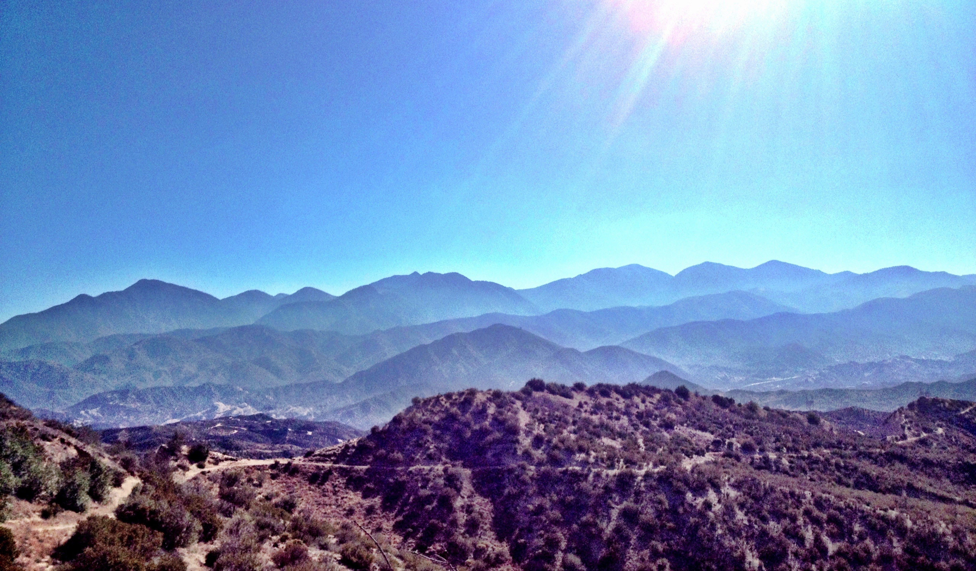
Glory hallelujah! We have made it to the promised land of Kennedy Meadows – the portal to the mountains, the gateway to the High Sierras! That holy place on the PCT where the hot and dry desert of Southern California ends and the landscape transforms into mountains, passes, snow-fed rivers and scenic vistas. This is what we’ve been looking forward to for the past 32 days, the sole incentive that has kept us going the last 700 miles. The desert hike however, did go out with a bang.
Due to the large Powerhouse Fire, a big portion of the PCT was burned between Agua Dulce and our next resupply in Tehachapi. The PCT Association made a detour around the fire, but that too became closed as the fire burned through the detour. Our plan then was to just shuttle around the burn section, which would cut off about 100 miles of hiking. The day before we were to be shuttled around the fire, a small section of the detour was opened, which we learned consisted of a roadwalk that paralleled the LA aqueduct for 30 miles through the Mojave desert. Our immediate reaction to this information was that this just sounded very not fun (see last blog post); and when we added my history of stress fractures in both feet, as well as Carter’s healing knees, we decided to stick to our original plan and forgo the 30 miles of concrete walking.

We were dropped off in Tehachapi to pick up our next resupply late afternoon on day 25. After filling our packs to the brim with new food, we were about to walk over to the I-5 on on-ramp so that we could hitch 15 miles up the road to where the trail started up again when an older gentleman pulled up.
“You kids hiking that trail thing?” he asked.
We sure were.
“Well if you want a ride to the trailhead, I can give you one after I’m done checking my PO box.”
“Why thank you sir.”

We learned that Dave was an ex-military paratrooper, but nowadays, around these parts, he was known as the jam-man because of the large non-commercial jam business that he kept out of his house. And he added that he would be more than happy to have us sample some of his jams if we had time, as his house was right on the way to the trail. Well, why not? we thought. He brought us into his house where we met his wife and he treated us to a vast and unique array of jam samples: cherry-mango, red cactus-grapefruit-peach, apricot-pineapple. Dave then offered to grill us up some hotdogs, to which we had no objections.

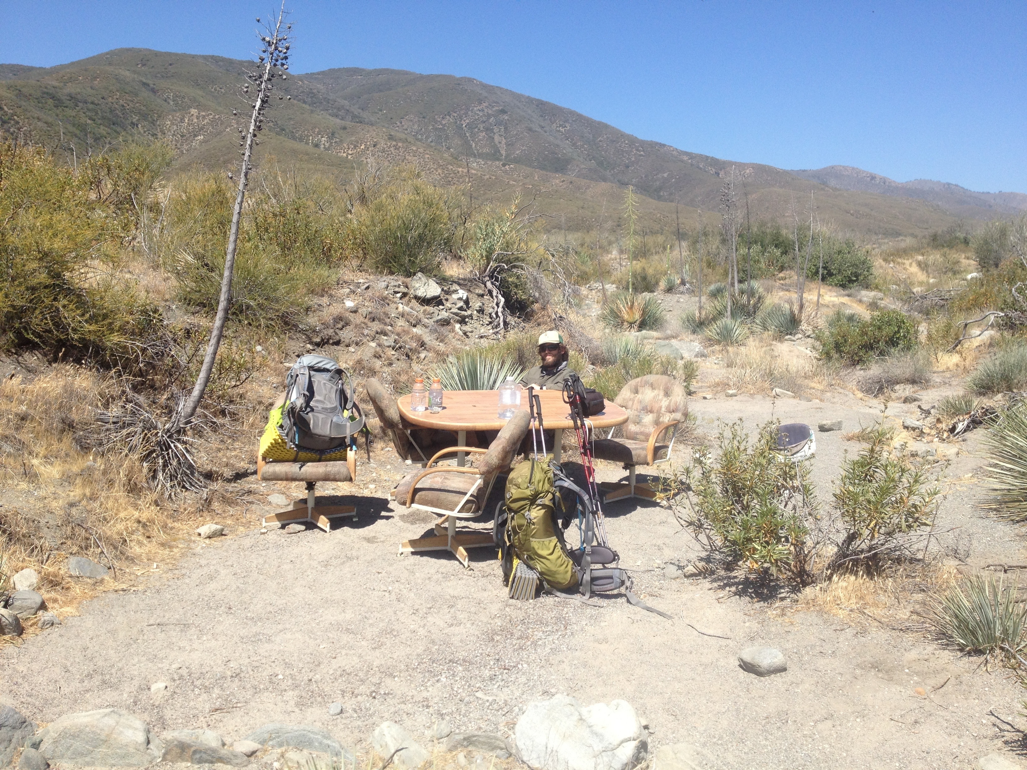
One of my favorite parts of the trail so far has been the unsolicited, genuinely random acts of kindness that we have experienced over the past month. Whether it be Trail Angels or Trail Magic, or other generous people that are willing to take dirty hikers into their homes, or the people who pick us up as we are hitching into resupply towns, it has been humbling and inspiring to be treated so well by total strangers. One Trail Angel once told us, “The trail will provide,” and thus far we have been pleasantly, and gratefully, surprised to find this as truth.
After having eaten our fill and riding a little sugar buzz from so much jam sampling, Dave dropped us off at the trailhead, gifting each of us with a jar of his famous jam. While it definitely added a few extra ounces to our already bulging packs, the extra sugar kick was greatly appreciated over the next few days. And we were back on the trail.

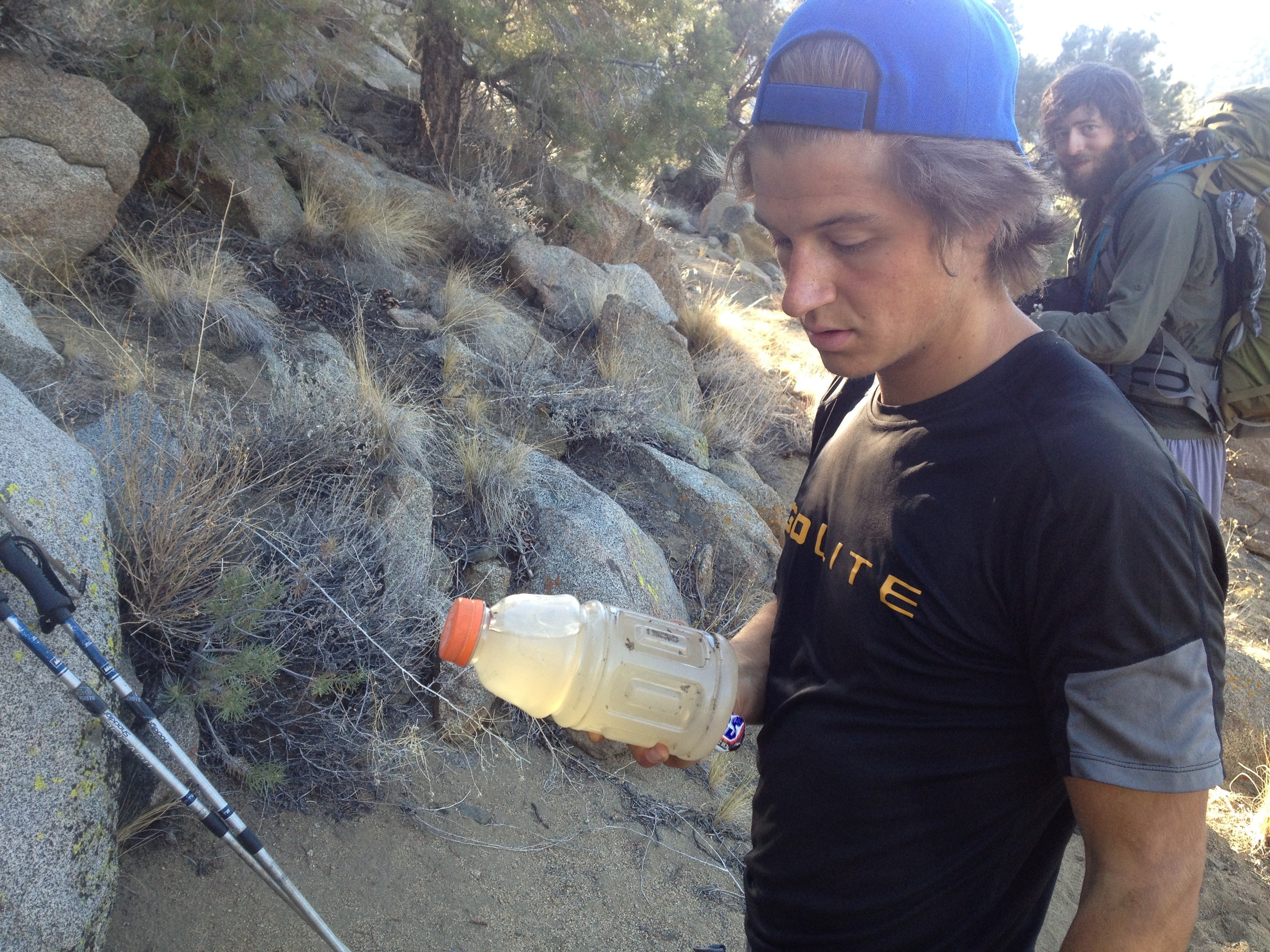
The desert went ‘out with a bang’ I say for a couple reasons. First off, water sources were the fewest and furthest between that we’ve encountered so far. Not too mention that the water report that we were using was outdated, or unreliable as we soon found out. There were weird obstacles to some of the sources (such as water that was tainted with uranium, and another spring that was frequented by a juvenile bear cub that was apparently not afraid of hikers). Besides water, our biggest challenge was that we were carrying the most food that we had thus far. This was the longest section that we’d hiked so far without any trail angels, planned resupply or nearby civilization to speak of, so we were carrying seven days, or 145 miles of food. Needless to say, our packs were pretty heavy.

We reached our first water source 20 miles in at around 2 pm the next day. The water report from about three weeks prior had read “good flow, clear water.” However, we found the piped spring with a trickle of water flowing at a rate of about 1 liter every five minutes. We cooked there, using about 1 liter each, and then ‘cameled up’ for the next 20 mile dry section with about four liters each, taking over an hour to fill our water.

We’ve figured out that carrying about one liter per every five miles works out really well. We don’t get too thirsty, and don’t end up carrying an exorbitant amount of weight in water, for the most part. One liter of water weighs about two pounds, so for the sake of my feet and knees, my carrying capacity maxes out at four liters with two water bottles and one two liter platypus. Gus and Carter, on the other hand are prepared for much longer sections with carrying capacities of seven liters (14 lbs) and nine liters (18 lbs!) respectively. Both of them filled their water-carrying capacity to the max on a couple occasions this stretch when unreliable water caches were our only sources for long stretches.
To add insult to injury the next hot desert day, we ended up sidehilling through an old burn section for the better part of the day with very little respite from the sun (which Gus took to calling the ‘evil orb’) until we reached a pretty clear and consistent stream.

I did have two close encounters with nature that day. The first happened as I was hiking by myself in the early morning when I heard a thump tha-thump tha-thump on the trail behind me. I turned around to see a big black cow barreling down the trail right towards me. I literally dove off the trail and started to look around for a tree to climb lest the animal was some sort of manic cow or wild bull. Luckily the cow was merely on a determined quest down the trail, not specifically at me. Nonetheless, I was a little shaken up and waited for Gus and Carter before crossing the next cow pasture.

The other close call happened later in the day when I excused myself from the trail to take a pee break. As I was scanning the surrounding area for any other human inhabitants, I neglected to observe the area immediately surrounding me and it wasn’t until I was considerably closer to the ground that I looked up to find myself staring at rattler, coiled and tongue-flicking, about three feet away, camouflaged into a shrub. I think that it was as surprised as I was because the little guy failed to warn me of its presence with its rattle. I rushed back to the trail exclaiming loudly, pants around my knees, to find a laughing Gus and Carter, who thought that I was a funny sight to see, but were also mildly concerned that I had been poodle-dogged by the poison-oak type plant. I assured them that there was no poodle dog on my hiney, but did bring them back to the shrub to show them proof of the silent rattle snake. Definitely learned a lesson that day.

The third day was more of the same: sandy, rolling desert hills. However, on this day, we all began to feel effects of a phenomena called ‘hiker hunger.’
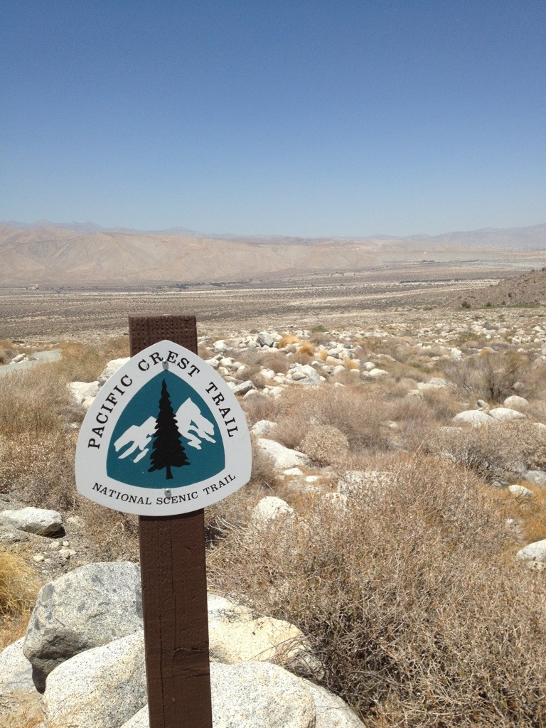
Hiker hunger is something that usually happens to hiker after a few weeks on the trail when ones body and metabolism gets used to the continual expenditure of energy that is thru-hiking. We’d felt our metabolisms getting faster and we’d definitely been eating more than we ever have, but on this day, hiker hunger hit us all full force. We turned into voracious baby dinosaurs waxing through our food bags like they were bottomless. However, later that night as we were looking for extra food that we could spare for a dessert, we found that, unfortunately, all of our food bags did have bottoms, and even more unfortunate was that we were close to reaching them. We still had three and a half days, or 65 miles to go. We were in definite need of an impromptu resupply. After consulting the map, we found that the PCT crossed a freeway at Walker Pass, about 15 miles from where we were camped. It’s a good thing that that freeway was there because when we reached Walker Pass the next day, I had a grand total of 2700 calories in my food bag between bars, tuna packets and mashed potatoes. The boys weren’t much better off.

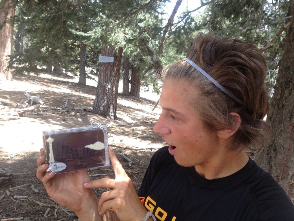
We tried our luck hitching into the nearest town about 20 miles away and were picked up after about an hour by a nice boy scout camp leader who told us hat he too was planning to hike the PCT in 2016 after he finished nursing school. He dropped us off in the quaint town of Inyokern, which consisted of a gas station, Mexican restaurant and various western-themed antique shops. We loaded up on gas station food for the remaining miles to Kennedy Meadows, which consisted of lots of sugar and lots of salt, our two main cravings while on the trail. After fueling up on chicken enchiladas from Bernadinos Mexican restaurant, we hitched back to the trailhead for the last 52 miles of desert. Our blood sugar levels stayed elevated for the next two and a half days to Kennedy Meadows. We bypassed the uranium tainted water without needing direly to use it. We didn’t encounter the juvenile bear cub at the source where we did need water, AND we were greeted by boxes full of delicious homemade treats from our Oma and Opa in Kennedy Meadows. Yum!

Our hiking routine fell into a sort of measured tempo in this last longer stretch of relatively uninterrupted hiking. Most days we were up at five to beat the heat, broke camp and were hiking by 5:30. We would stop for a snack and elevate-feet break every two hours, or when we would hit a water source, whichever came first. The first hour of the day is always hardest for me. There’s the physical pain of blisters and sore muscles waking and warming up coupled with the mental agony of figuring out how you’re going to stave off boredom for another ten hours that day. But by the end of the first hour, the body is usually broken in and warmed up and I’ve fallen into some daydream or some scheme for future life plans. If boredom prevails, Gus and I have found that, as a last resort, step-counting actually passes the time pretty fast. It gets sort of meditative and hey, what else are you gonna do?
We all were looking forward to magic day 30 on the trail where we thought (for some arbitrary reason) that all of our aches and pains would be gone and we would be hiking virtually pain-free. Unfortunately, we have learned that that is not the case. While we are a bit more comfortable than the first three weeks, we’ve come to learn that the nature of thru-hiking is decidedly not comfortable. As Gus put it the other day, all that’s really changed in the pain realm is that we’re all just really used to the constant minor discomfort that comes with constant walking all day, every day.

Another revelation that Gus had was that thru-hiking is decidedly not back-packing. Unlike our previous 5-10 day escapades into the Northern Cascades, where we would carry more than enough food, water was plentiful, we would hike between 10 and 15 miles a day and undoubtedly have some beautiful place, be it an alpine lake or mountain vista, as our destination, thru-hiking is a different animal altogether. We’ve found that it’s more about the balance between going as hard as you can, but always with longevity in mind. You want to make it to Canada. You go as far as you can while taking the necessary precautions to prolong the life of your feet and knees. It is also about number crunching. It gets weirdly competitive when talking mileage with other thru-hikers and everyone has their own strategy to get the most out of every day. But at the very essence, thru-hiking is just putting your nose to the grindstone and not letting even a smidgeon of doubt that you won’t finish the trail, or the thought that you’d rather be doing something else, enter your mind. A unique experience it is.

On a brighter note, our little group is getting along swimmingly. Gus provides comic relief, Carter, entertaining anecdotes and dramatic outcries from me (usually directed at the trail, but sometimes at the boys) all coupled with non-sequitur commentary throughout the day. We’ve also been hiking on and off with a few other like-minded and similar-paced hikers which has been a good time too.

Anyways, we are all happy campers here in Kennedy Meadows, drinking $1.25 bottomless cups of ice-cold lemonade and eating our fill of food from the one and only Kennedy Meadows General Store. We are greatly looking forward to the next section where we will be climbing into the High Sierras and staying above 9000 feet for the next ten days, hopefully being able to climb Mt. Whitney on a layover day.
So, that’s life from the trail, in a nutshell. Thank you for all of the encouragement and good wishes. It definitely goes a long way when we’ve been hiking all day, for many days, and can only think of how nice air-conditioning, running water, and a bed, would be. But all in all, we are still stoked to be out here and ever more excited for whats to come.

Until next time,
Elena

20130704-110548.jpg

20130704-110616.jpg

20130704-110749.jpg

20130704-110811.jpg

20130704-110645.jpg

20130704-110714.jpg

20130704-110826.jpg

20130704-110848.jpg

20130704-110924.jpg

20130704-110956.jpg

20130704-111301.jpg

20130704-111034.jpg

The Pacific Crest Road- Gus

I write this as I lay suffering from HBD (Hiker Binge Disorder). It’s what occurs when hungry hikers come off of the trail to towns where food is plentiful. Then hikers eat until they can eat no more, but they decide to eat more. It’s an unpleasant affliction which can only be cured by hitting the trail again.
Elena, carter, and I are all resting our bodies in Agua Dulce at a trail angel’s house called Hiker Heaven. It’s a large backyard with tents and cots all over. It’s a large hiker compound. The past week of hiking has been anything but a scenic trail. After we all stayed at Marion’s house (another big thanks for hospitality, rejuvenation, and a boost to morale) we climbed up in to the San Gabriel mountains from Cajon Pass.

20130611-113740.jpg
The trail ascended until it descended and then would ascend once again. It’s like we’re just walking on an elevated treadmill, except in Southern California, and without an end in sight. The trail roller-coastered through the San Gabriel’s for a couple of days until I reached what was to be the first of many road-walks. I had the choice to either take a 20 mile trail detour or a 5 mile road walk to bypass a 4 mile section of the PCT. The trail was closed to protect a toad. I chose the road walk because 5 is less than 20. I walked on the highway as cars sped by showing me how slow humans walk. Ten miles later the trail began to be impassable due to the vicious poodle-dog bush.

20130611-122546.jpg
Poodle-dog bush is green leafy plant with purple flowers that grows rampantly in burn area a year after a fire. It gives people a rash that is similar to poison oak. It’s scent is a mix of minty dirty feet and marijuana. PCT legend has it that one hiker thought that a poodle-dog bush was some dank OG Cali bud and smoked it. The same hiker was later hospitalised. Anyways, I took another road walk for the next 36 miles to avoid any potential conflict with this mean bush. After this day I decided that roads are for cars and trails are for humans. The next day I finally reached Agua Dulce and left the barren Angeles National Poodle-Dog Bushery. Although the trail hasn’t been scenic lately, or even a trail, I celebrated the 400 mile milestone and my high school graduation.

20130611-124326.jpg

20130611-125613.jpg
People on the trail have many different mind sets. There is the ultralight crowd who try to minimise the weight of their packs and maximise their mileage. Then there are the PCT purists who need to walk every inch of the trail with their own arbitrary set of rules which they believe to be universal. Unfortunately, both of these groups of people carry the assumption that everyone thinks the same as them. I’ve come to the conclusion that the right way to hike the Pacific Crest Trail, or do anything for that matter, is the way that makes it the most enjoyable and fun. After all, if you’re not having a good time doing something, then why would you keep doing what you’re doing?
We should all reach the holy grail, Kennedy Meadows, in the next week which will indicate the end of our desert days. It’s only the beginning of the trail, but I’m already looking forward to the gray, chilly, drizzly, wet, wonderful days of the Pacific Northwest.

Lions, tigers, bears and…panthers? Oh my! (day 18/ mile 325)

After a rejuvenating, gluttonous and pack-free zero day in Idyllwild, CA, we headed back out onto the trail and up into the San Jacinto mountain range. Unfortunately Carter had to take a brief hiatus from the trail to rest what is hopefully a minor strain in his knee. Gus and I climbed for the better part of the first day. Although it was a haul with all of the newly acquired food from our food re supply in Idyllwild, we were both relieved to have a break from the unrelenting desert heat that we’d been experiencing on the valley floor. We took a detour to the top of the San Jacinto summit where Gus and I split a coveted bar of Seattle’s Best Chocolate while enjoying a breeze-filled rest (thanks mom and dad!) .20130603-220641.jpg20130603-220756.jpg That night was spent on top of Fuller Ridge where we could see the twinkling lights of Palm Springs extending out into oblivion on one side and headlights of cars driving down the I-10 on the other.
But what goes up must come down. While most days of hiking in the desert tend to blend into one another, the next day proved to be quite memorable, in terms of days hiked on the PCT. We had been heartily forewarned by many a PCT veteran, as well as Trail Angels, about the descent or The Descent from San Jacinto. The Descent consists of a 16 mile section of exposed switchbacks with no water sources or caches along the entire downhill slog. In addition to this nightmare for knees, there is the additional mental challenge of being able to see your destination the whole time: a bridge crossing the I-10. As the crow flies, it was 4.2 miles from our camp at Fuller Ridge to the I-10 crossing; however, by trail, the section included 20 miles of walking, 16 of them relentless downhill switchbacks. One fellow thru-hiker who had attempted the PCT last year told us his story of The Descent, where he ran out of water halfway down and had to call the sheriff. While the sheriff didn’t brave going up the switchbacks to rescue the guy, he did meet him at the bottom with plenty of water and an ice cream bar. Another Trail Angel warned us about this section and told us that two hikers had to be heli-evac-ed from The Descent last year due to dehydration.
Heeding these stories led to caution: Gus and i woke before the birds were up and got a nice and early alpine start at 3 am. This day tested both of our commitment to the trail most thoroughly. As new blisters formed on the fronts of our toes, while our thighs and knees screamed against the seemingly endless downhill, we were not too happy with the PCT. Gus threatened to break up with her while I gave her the silent treatment for a few hours. Despite our early start, the last two hours of traversing back and forth and back again were still gruelingly hot. We reached the bottom water faucet around noon, where I chugged a whole liter of water before even sitting down. Good riddance to that section.
We rolled into Trail Angels Ziggy and the Bear’s house around 4 pm. We were greeted by Epsom salt foot baths, a big tray of salad and about a pint of ice cream each. Thank goodness for Trail Angels!20130604-055038.jpg
There were about four other thru-hikers staying at Ziggy and the Bear’s, but having started at the tail end of the North Bound (Nobo) PCT thru- hiker season (most people start April 15th-end of May), we haven’t run into too many other hikers yet. According to one Trail Angel, there were 1200 NoBo permits issued this year. He estimated that 400 people would make it the first 700 miles through the SoCal desert, and only 200 of those would actually finish the trail. I guess the number one factor that contributes to people dropping out is the uncontrollable reality of injury. I’m convinced thus far that bodies are not meant to hike 20+ miles a day, carrying weight, for so many consecutive days. It results in some interesting pains and ailments to be sure. We’ve also heard that the mental challenge of continuing the monotony of walking every day takes its toll up in NorCal when you hit the half way mark at mile 1330, but still just haven’t made it out of California. And of course many other variables are at play in the low overall success rate like running out of funds, time or “real life” commitments that one needs to get back to. Although the figures are not promising, we’ve taken on the PCT motto of HYOH or “hike your own hike,” which really just means listen to your body and do what is necessary to hike sustainably rather than hiking fast. Even with the low percentage of PCT finishers, Gus and I were numbers 727 and 728 to sign the log book at Ziggy an the Bear’s for the PCT class of 2013, meaning that a considerable number of hikers had at least made it to mile 210.
The next day (Thursday) took us through Mesa wind farm and up through the San Gorgonio wilderness, where we saw three different species of snakes, a few desert hares, many cute cottontails and about a gazillion lizards. We were definitely back down in the unforgiving heat of the valley which we dealt with by taking a four hour long lunch break to wait out the hottest part of the day in the shade.

20130604-083633.jpg

20130604-055150.jpg

20130604-083712.jpg
Friday, or day 14, was one filled with surprises. The first one came about as we made our way into the San Bernardino National Forest and turned a corner only to find a big brown bear sitting on her haunches about fifty feet away…behind a chain link fence. As we ventured closer to investigate we found that not only were there two brown bears in cages, but there was also a tiger, a lion and a panther behind the fence on this property. After consulting the map with some confusion, we found that the PCT bypassed animal stunt cages (predatorsinaction.com) and that these animals were actually Hollywood stars who were relegated to these 20×20 foot cages when they weren’t being used for the big screen. This sight was as surprising as it was sobering and with little else to occupy my mind when walking for so many hours at a time, the next few miles I spent daydreaming about the wild safari animal rescue shelter I would make when I got back from the PCT.

20130604-085021.jpg
I was thankfully distracted from my melancholy reverie by some trail magic : a cache of soda and waters, where Gus and I decided to make a hot lunch to use up some of the weight in our packs. Rehydrated spaghetti and meatballs for him and cheddar broccoli rice with tuna for me.

20130604-111816.jpg
As we were finishing up our lunches, another pleasant surprise came wandering up the trail. A couple walked up and sat down with us in the shade and we began the typical hiker exchange. “Where did you start?” ( They were section hiking the trail) “where are you from?” (San Diego) “what are your names?” Deb, the woman answered, Halfmile, the man said. It was THE Halfmile, a real life PCT celebrity!
So, to back up a bit, there are two main ways that hikers navigate themselves along the PCT. The first is the old fashioned paper map method, where one prints out all 2663 miles of maps and then puts them in their re supply boxes along the way. The other, and more popular option we’ve found, is to download one of the three PCT apps and then cache all the maps to ones smart phone so that they can be used without needing to be in a service area. We re using a mixture of both methods. The most commonly used PCT map and app is called Halfmile PCT and not only does it have all 2,663 miles of the PCT on topographic maps, updated trail notes, water reports and fire warnings, but it also has a feature ( which can be a blessing and a curse) that uses GPS to tell you exactly what mile you are on on the PCT.

20130604-114510.jpg

20130604-114537.jpg We had speculated on who this mysterious Halfmile was. Was s/he a crazy ultra light hiker that thru-hiked the trail every year? Or was s/he an unmanned drone that flew over the trail and kept tabs on conditions? It turned out that Halfmile was a regular guy who liked to hike and had a background in IT. He was awesome enough to section hike the PCT and make the most useful app that is out there for PCT navigation.
Gus and I gave our thanks to the guy who had basically made it possible to get to where we were on the trail, and then headed on our way.
Not two miles down the road we happened upon yet ANOTHER bit of trail magic. This time it was a recliner couch with water and sodas and a cooler full of strawberry and fig newtons, bananas and cookies. There was also a much needed tube of IcyHot that I slathered all over my knees.

20130604-115740.jpg Buoyed by our good fortune that day and encouraged by the prospect of seeing Carter in Big Bear City, Gus and I powered out 13 more miles, getting to the trailhead at 10 pm and making it our first (and hopefully only, for awhile) 30-mile day. Trail Angels, Papa Smurf and Mountain Mama, picked us up and took us to their house where we were fed delicious lasagna and ice cream and were able to shower and do laundry.
Big Bear marks being 1/10 done with the trail and almost halfway done with the SoCal desert, which ends at mile 700 in Kennedy Meadows . However, the most exciting milestone for me is that we are almost done with our first book of maps!

20130604-120456.jpg Slowly but surely we are making our way home. We are back on the trail now and camped last night at mile 317. We celebrated the 300 mile mark with a dinner of Mac n cheese and tuna with snickers for dessert.
A humongous Thank You to our family friend Marion this week for housing Carter and making sure he followed the doctors orders of ice and rest. He is back on the trail in fine form and we hope that he (and all if us for that matter!) will stay that way for the next couple thousand miles!
Until next time, Elena

20130604-121248.jpg

20130604-121306.jpg
( our feet after one day of hiking)

20130604-121355.jpg